Best Portland Hikes in the Rain

Hiker, Writer, Traveler, Recovering Person
I’m the author of two books on Portland hikes: 60 Hikes Within 60 Miles of Portland and Day and Section Hikes on the Oregon PCT. I try to get out there as much as I can, and I try to keep up with all the latest news and developments out on the trail. Check here for news, stories, and photographs from the great outdoors. And you can also follow me as the 60 Hikes guy on Facebook or Twitter.
Continue reading “Photo and Video Slideshow: Silver Falls State Park, Oregon, 1-14-2021”

The trail reopened around December 31, 2020, and the highway exit on the following day. All of that can change any time, because especially after the fire, landslides will be more common in the area. That’s why the exit was closed, and Eagle Creek Canyon will be even more prone to slides than usual for quite a while.
Update: This trail did, in fact, close again in early January because of landslides. Check with the Columbia Gorge NSA for the latest.
Continue reading “Hiking Eagle Creek Trail After the Fire, 1-1-2021”

Think about those words along with something you love. Let them sink in, notice the feelings that come up.
Now try these on:
Damaged. Changed. Evolving. Resilient.

I went out and tried to hike some of the Oregon Coast Trail on September 21, 2020, and it is a total mess. There was no fire here, but I assume that what I saw was the result of winds around Labor Day.
Near as I can tell, you really can’t hike from Arch Cape to at least Cape Falcon right now, and in fact some of that trail is officially closed. Continue reading “September, 2020: The Oregon Coast Trail South of Arch Cape is a Windblown Mess (And Some of it is Closed)”

MAJOR, CRITICAL DISCLAIMER: Just because a spot is within the area affected by a fire, it has not necessarily been burned to the ground! I cannot overstate the importance of this. Many fires skip around, burn only along the ground, and behave very differently from one area to the next. When the media says a fire is 35,000 acres, that does not necessarily translate into 35,000 acres of total destruction. Places within a burn zone could survive intact, be damaged … or be burned to the ground. We won’t know for a while.
Updated October 5, 2020: The Wind River Road is open again,
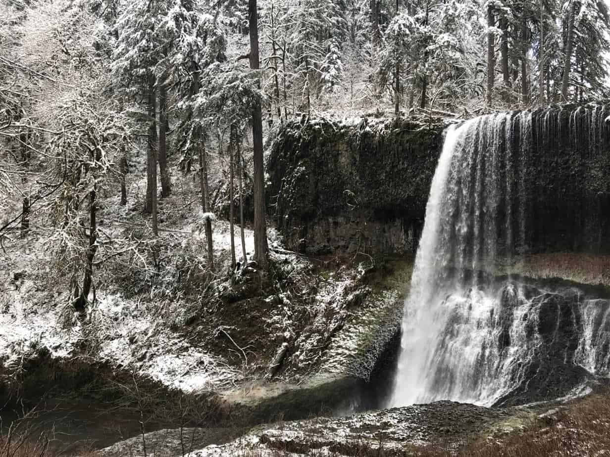
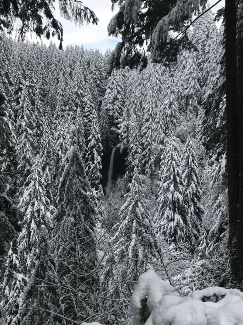
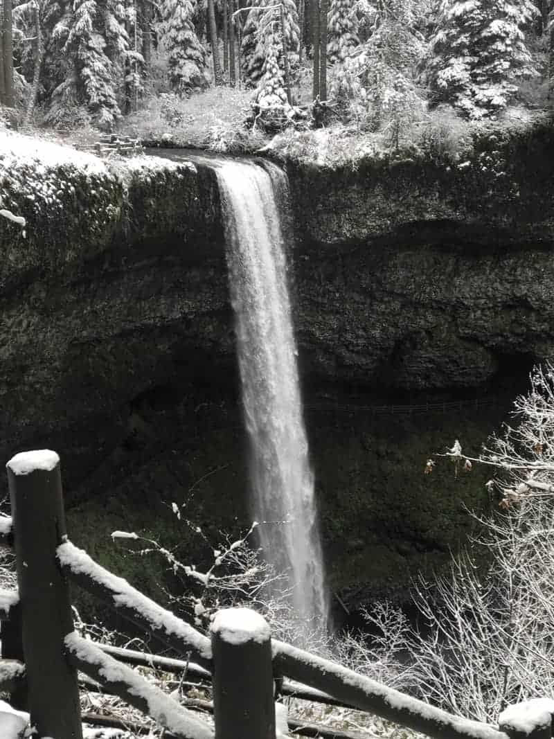
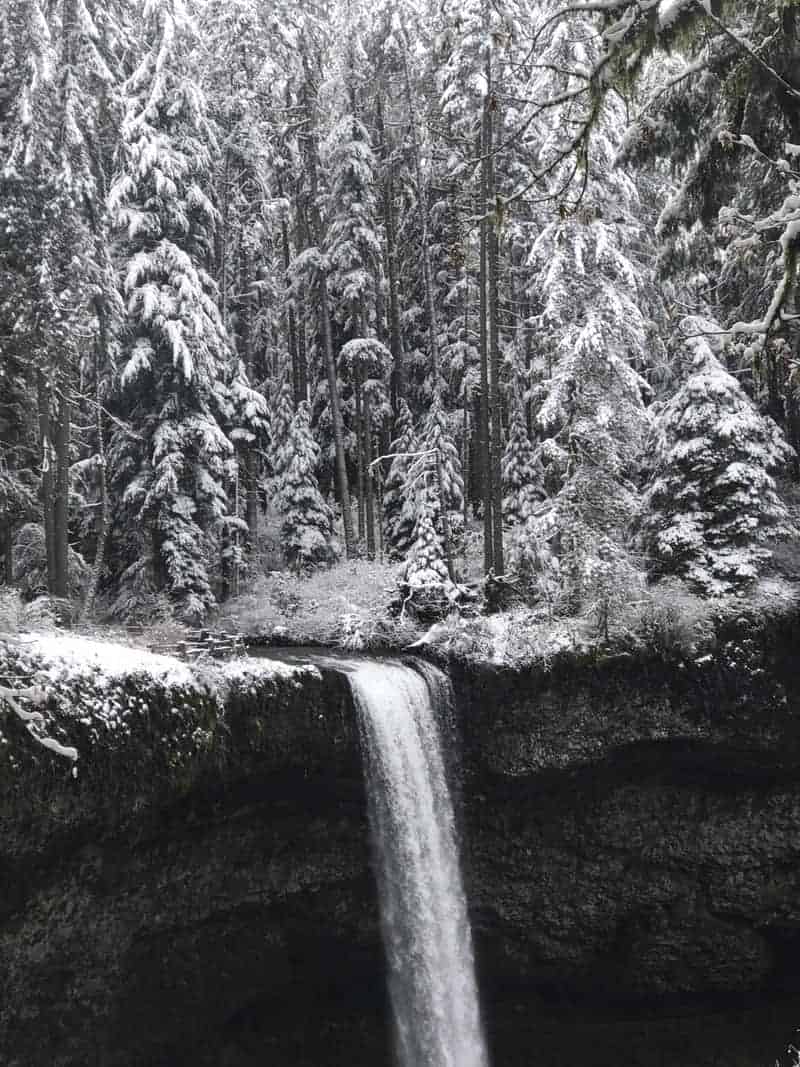
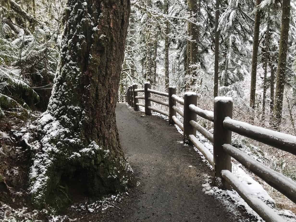
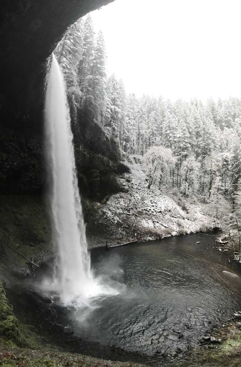
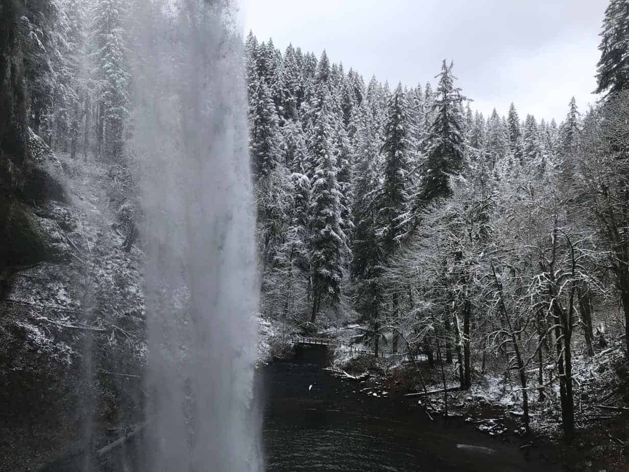
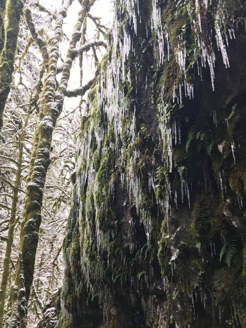
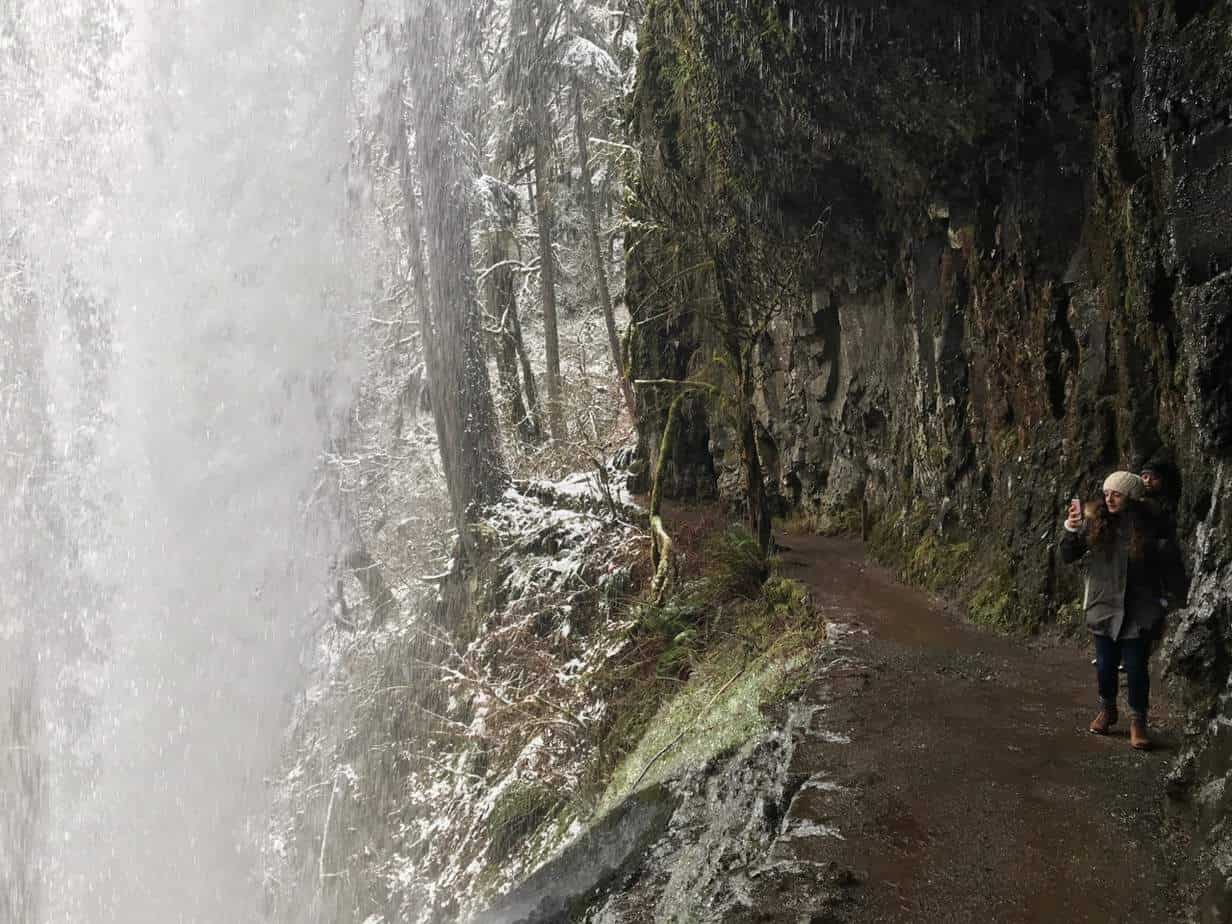
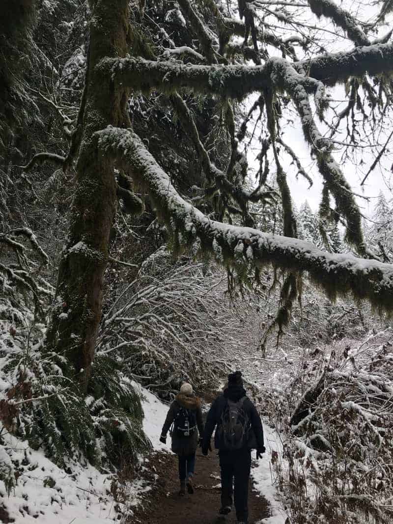
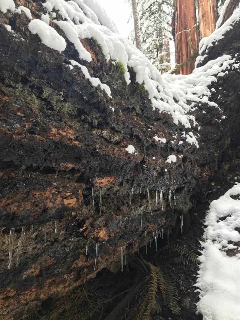
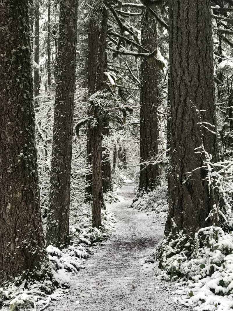
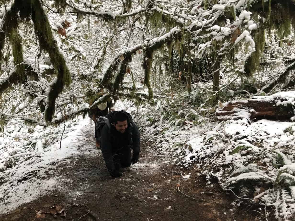
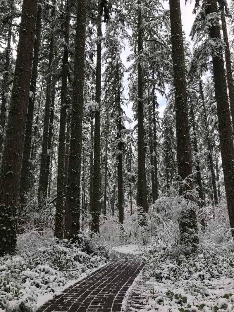
For one thing, there just aren’t that many people around, especially during the week. We visited on a Wednesday and saw four other cars in the parking lot! It had just showed a couple of inches the day before, and the temps had remained cold. So the snow was still on the trees and much of the trail.
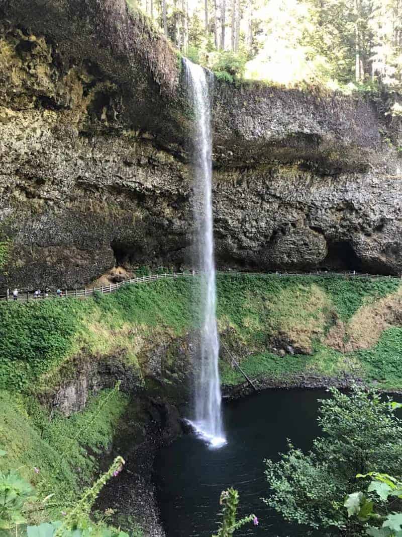
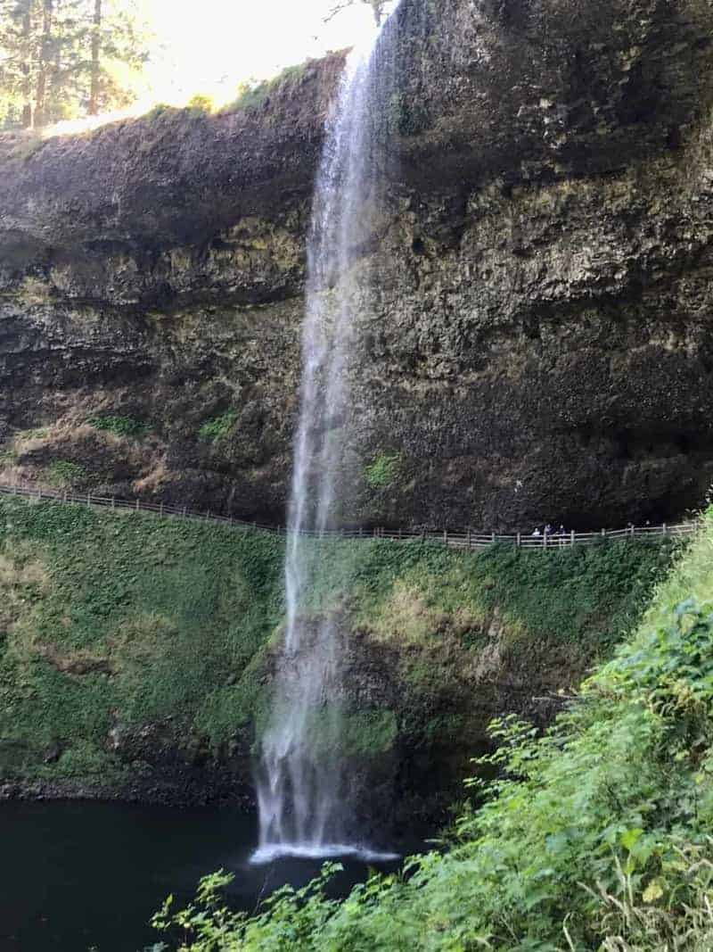
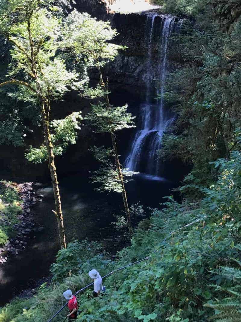
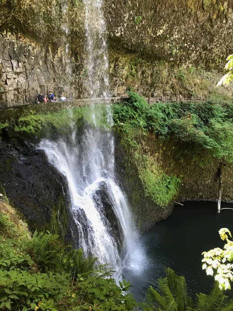
The combination of solitude and winter scenery made it a pretty special day on the Canyon Trail, aka “Trail of Ten Falls.” Enjoy the photo gallery below.
An important note: The trails can get real slippery in winter, so bring poles, and consider bringing traction devices. Check the park’s website for the latest conditions.


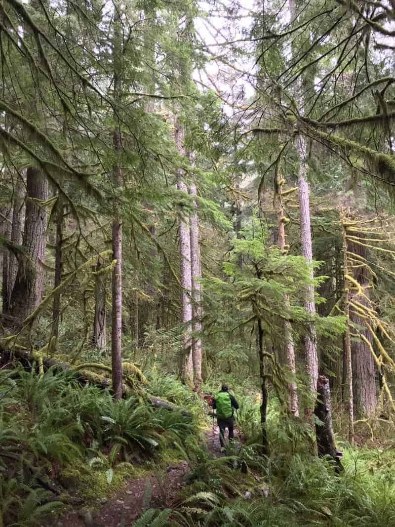
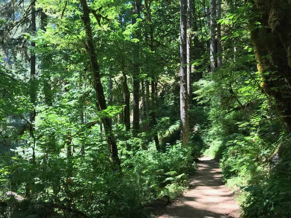
Well, at certain times of year, absolutely. And if it isn’t the peak of summer on a weekend, the Little North Santiam Trail fits the bill perfectly. I think of it as “Opal Creek without the crowds.”
Little North Santiam Traihead is about a two-hour drive from Portland: down I-5 to OR 22, east towards Detroit Lake, then north (left) up the Little North Santiam Road for about 15 miles to Elkhorn Drive. Here’s the West Trailhead on Google Maps.
From there, it’s about 4.5 miles along the river to the East Trailhead farther up OR 22, near Shady Cove Campground. So you could do a shuttle, or some people stash bikes at the upper trailhead, do the hike, then bike back down the road. Or you can do an out-and-back for as much as you’d like, up to 9 miles.
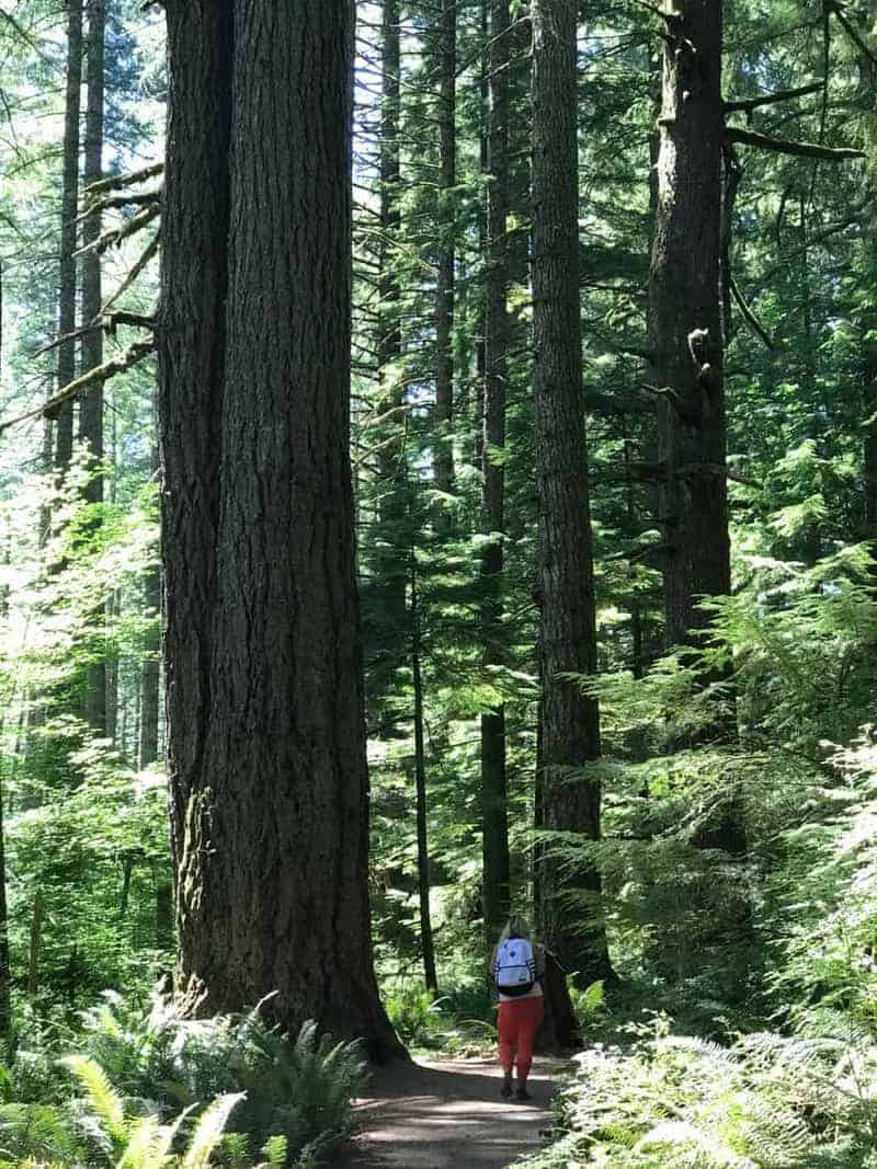
Basically the hike has three sections: the lower 1.5 miles from the West Trailhead, the upper 2 from the East, and the hill in between. But even the hill isn’t too intense, a climb of about 500 feet in a little over half a mile. But the views up there are more than worth it: a deep, narrow forested canyon with mountains all around and a raging river below.
In early February 2019, we started at West Trailhead did the lower section, the hill, and a little bit of the upper, to an area called Three Pools, where there will definitely be a lot of people in the summer since you can also drive there on the other side from the trail. So you would see those people but not necessarily share the trail with many of them.
But on our Sunday? We saw three other hiking groups all day, and nobody on the river.
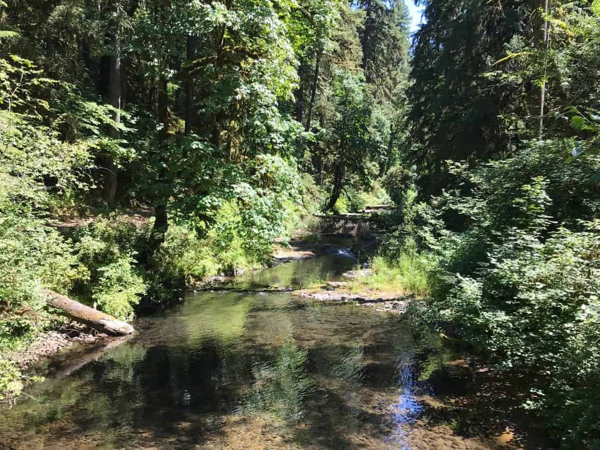
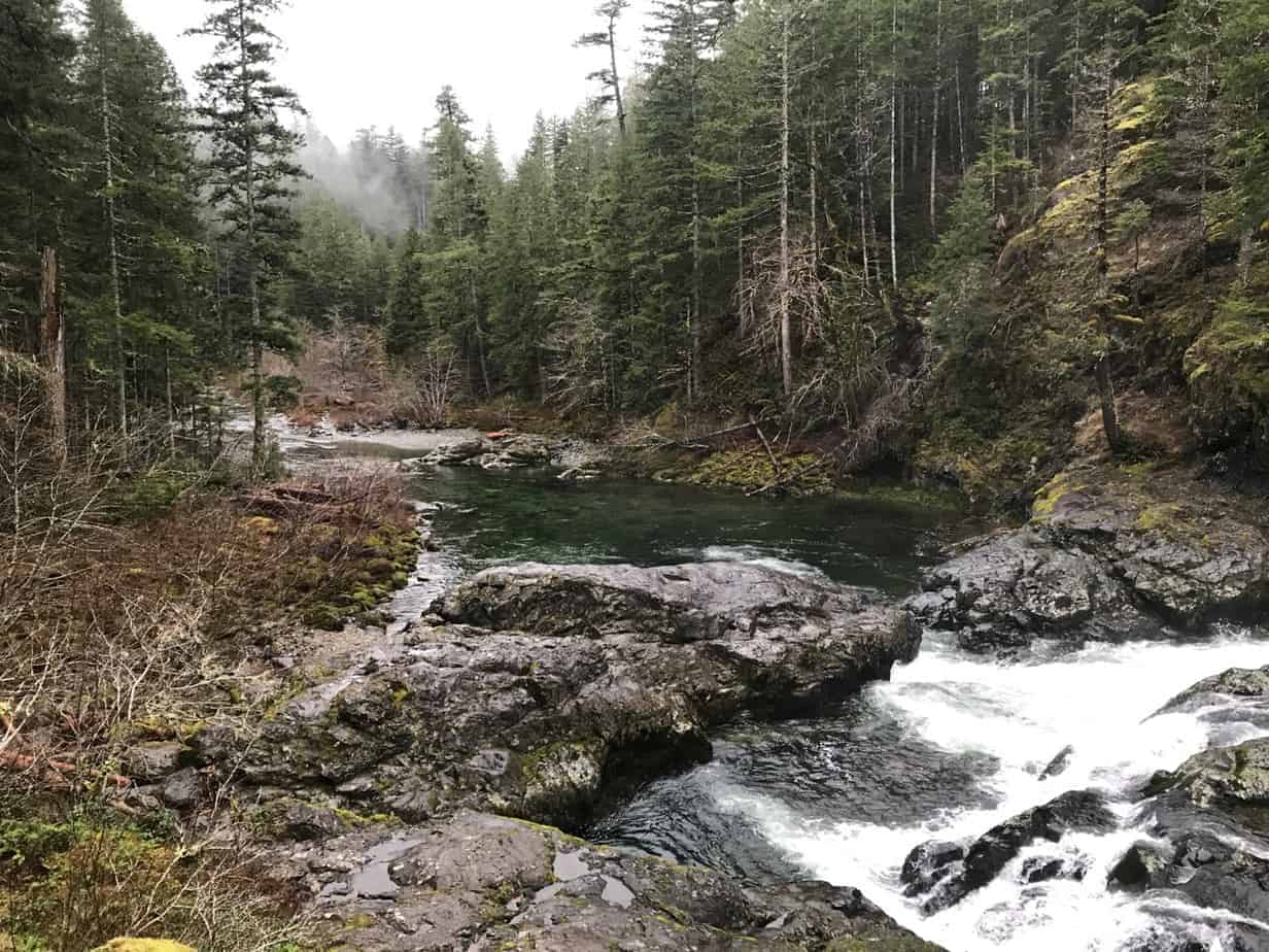
Here is a video of a waterfall on the lower section, barely a mile out from the trailhead we used.
A little ways beyond that waterfall, you start up the hill. It gets steep in places, and the trail is rocky with lots of roots. So even with only 500 feet of climbing, we were pretty winded when it was over.

In fact, when the trail is wet it’s what I would call “sneaky tough,” because it’s hard to get into Cruise Mode when you have to keep an eye out for footing all the time.
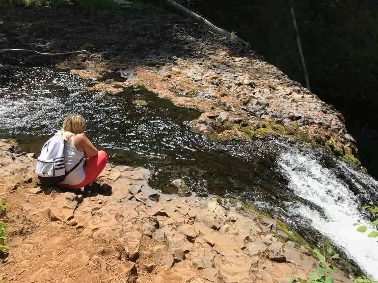
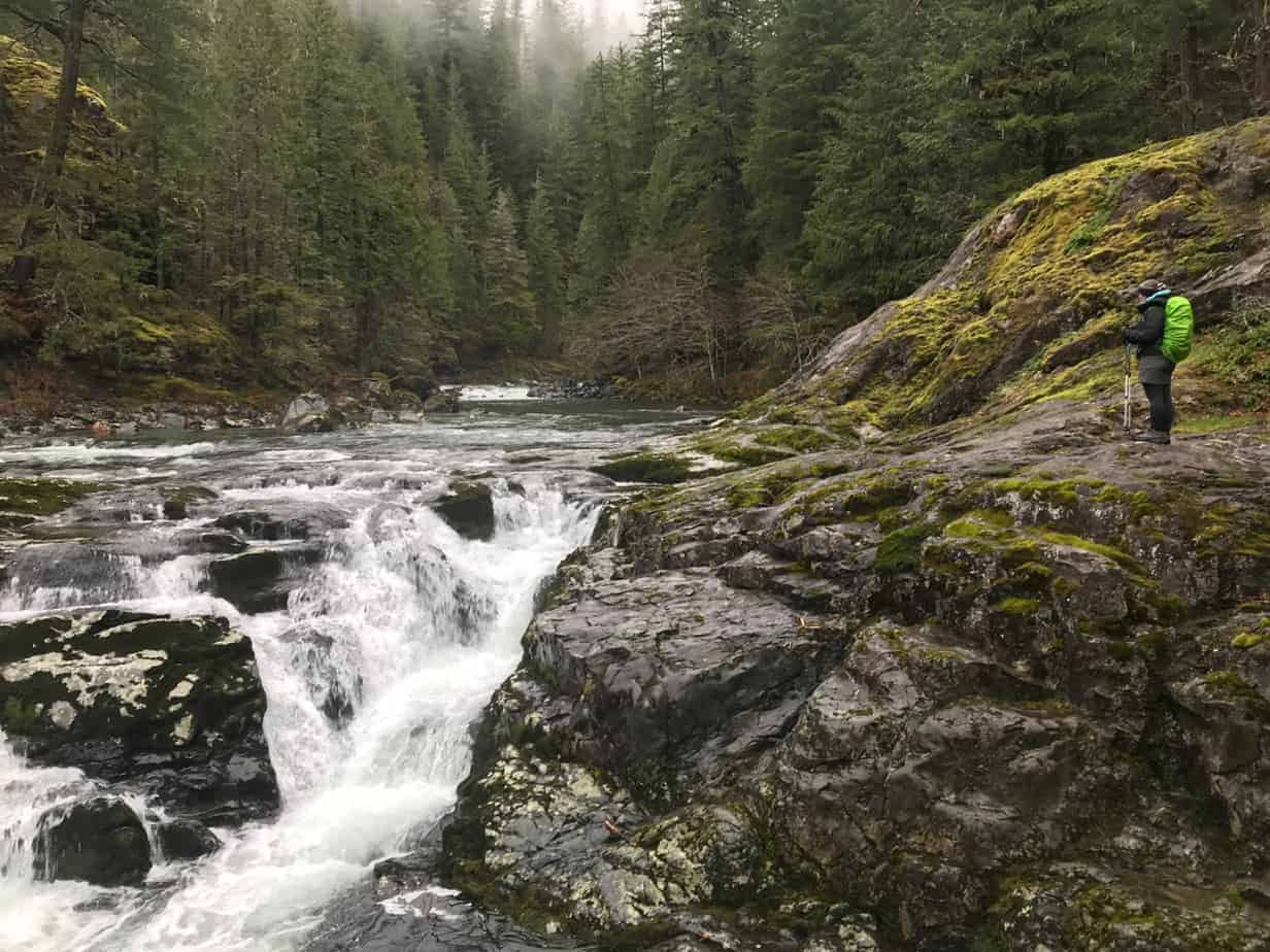
Beyond the viewpoint (right) you drop back down to the river and after another roly-poly mile arrive at the Three Pools, another spectacular series of waterfalls. There is also a dramatic rock pillar here, as well as a parking area on the far bank. So if it’s a warm summer day, especially a weekend, there will be folks swimming and hanging out here, but the great majority will be on the other side of the river.
Here is a video I shot from the Three Pools area, with the rock pillar in the trees to the right:
At that point, we headed back, but another mile up the river would have gotten us to the East Trailhead. So you could also start there and hit Three Pools just a mile downstream.
For more on this hike, see its Field Guide entry at oregonhikers.org.


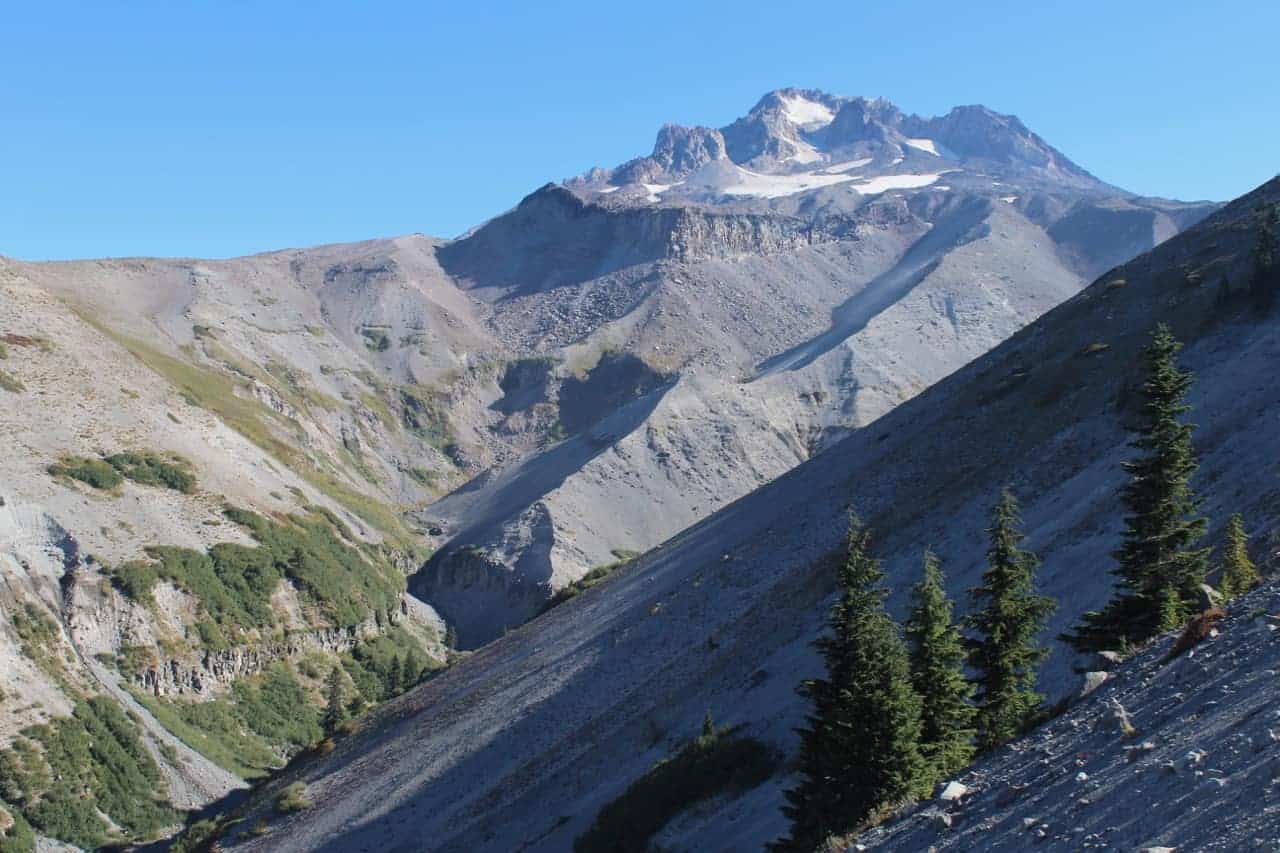
For one thing, it’s not just one hike. You can just go wandering around above the lodge and hardly put in any effort at all, but still enjoy great views and wildflowers and trees and little canyons. If you go 2.4 miles you can stand at the top of a massive gash in the side of Mt. Hood with a lovely stream hundreds feet below you. You can climb down there and see the creek and a waterfall.
And then you can go for the whole thing, which is what I did in the first week of September.
This is a 13.9-mile loop with 2,800 feet of ascent that took up nearly eight hours and most of my energy.
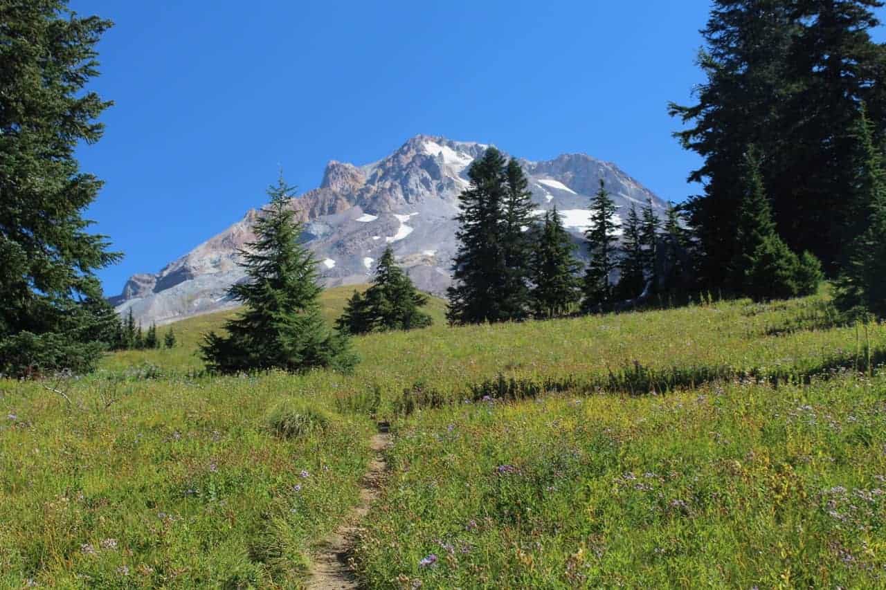
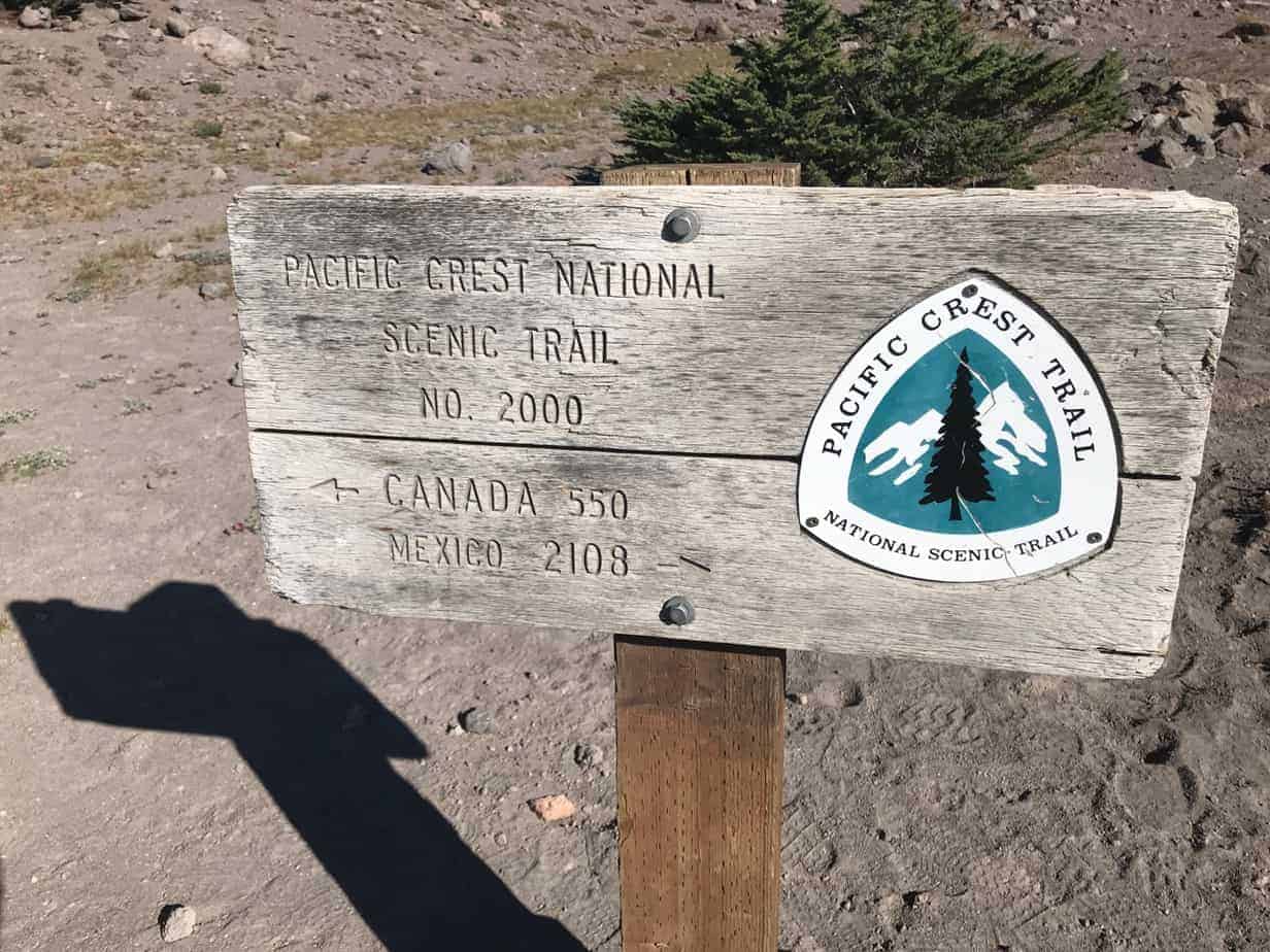
Starting from Timberline Lodge, which is worth a stop on its own, simply walk up the hill until you cross the Pacific Crest Trail, which stretches some 2,600 miles from Mexico to Canada. The mileages (left) are a bit humbling, and if it’s August or September you’ll probably meet some northbound “through-hikers” doing the whole thing. Turn left, and off you go.
After crossing under a few chairlifts and past a tower of cell phone antennas, you finally leave the ski area and enter Mount Hood Wilderness. It’s gradually downhill for 2,4 miles to the Zigzag overlook, where I shot this video:
A nice enough turn-around, but I kept going, down to the stream crossing and then back up the other side. This is the first hard part. The second, and real hard part is going back up from the creek to the viewpoint, then 2.4 miles back up to the lodge, at the end of the day when you already have about 9.5 miles under your belt. In the middle of the afternoon.
60 Hikes Within 60 Miles of Portland
Beyond the canyon, you climb to the intersection with the Paradise Park Loop Trail (turn right) and then the Paradise Park Trail. Confusing, I know. At the second one, in a beautiful meadow where I took the photo at the top of this post, go up a little farther. I went 0.4 miles up to some rocks, where I had a nice break and shot this video:
The main trail — here a combination of the PCT and the Timberline Trail around Mount Hood — continues over to the site of the old Paradise Park Shelter, a great lunch spot, then wanders through Paradise Park on a nearly three-mile loop, passing meadows and views and forests and flowers and waterfalls. It’s really pretty magical.
Then you come back to the Zigzag Canyon, go down it, cross the creek again, and then you pay your dues. The last 3.5 miles gain 1,400 feet of elevation, half of it in the first mile or so. Good times.
But it is some kind of worth it, if you’re up for the effort. Paradise Park is a beautiful spot indeed, and Timberline Lodge is a terrific place to wind up a hike. I mean, pizza and beer anyone?
Here is my Gaia track from the day:
You can get more details in my guidebook, 60 Hikes Within 60 Miles of Portland, which is for sale (signed as you like) right here.
And here is a photo gallery with some more details from the day:


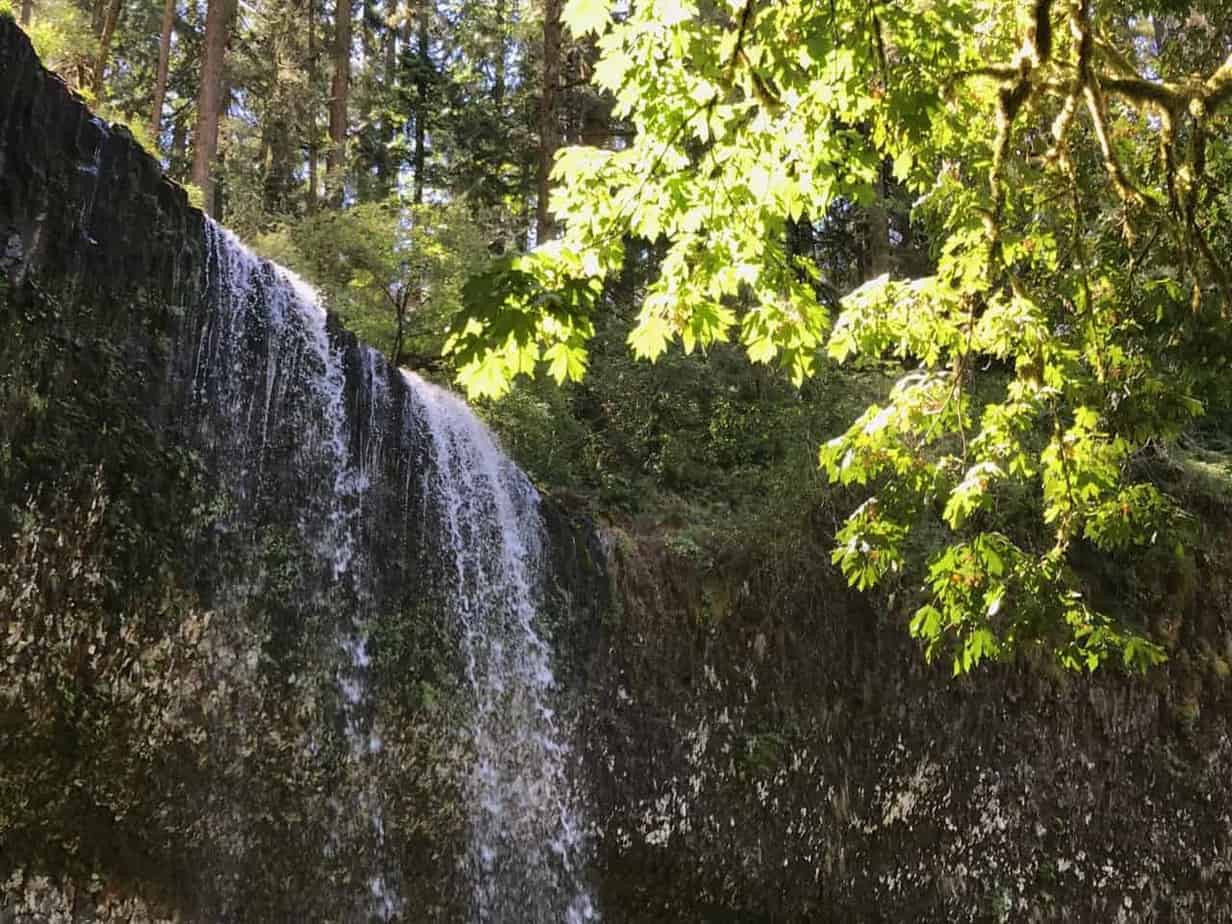
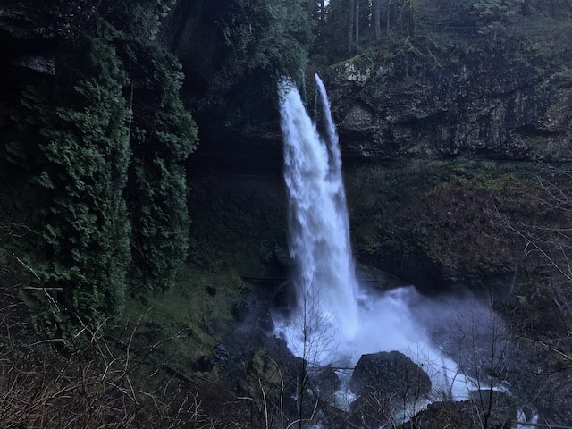
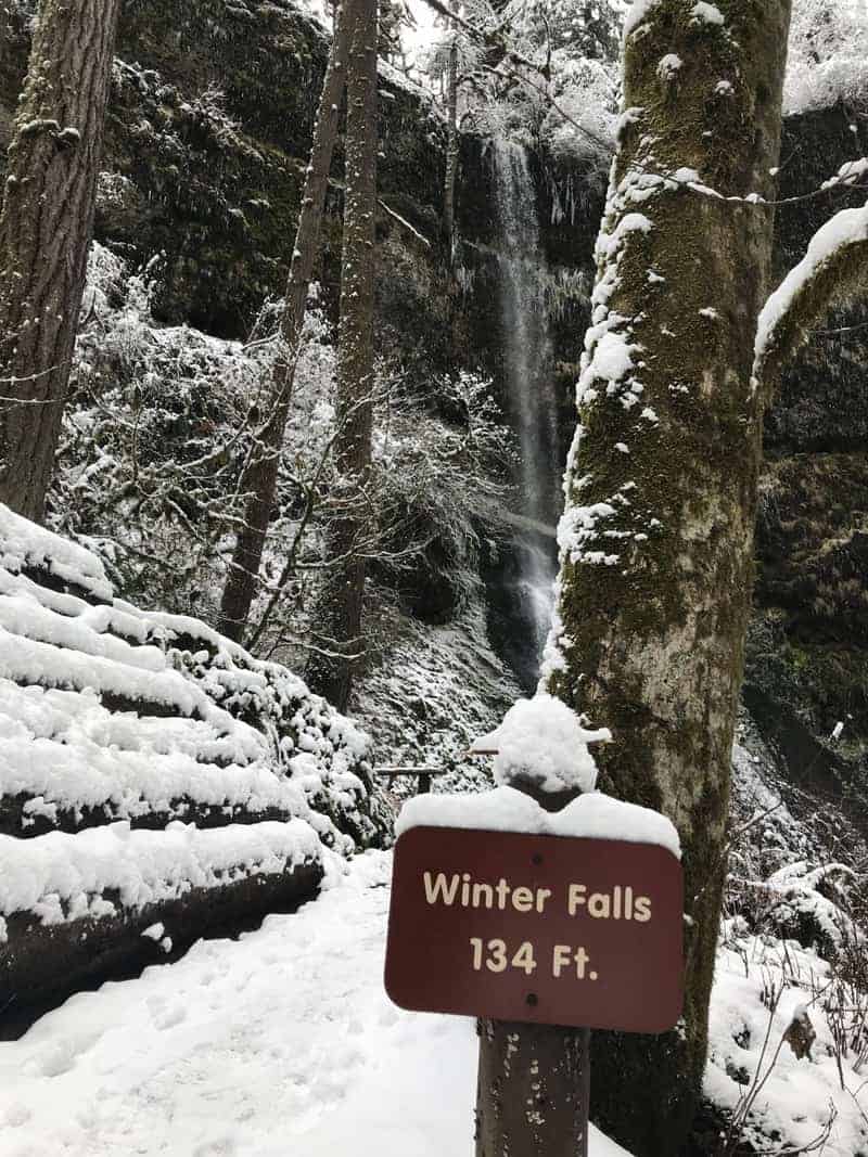
If you love waterfalls, you’ll love hiking the Trail of 10 Falls (officially the Canyon Trail) in Oregon’s Silver Falls State Park.