


If you are looking for a real conditioning hike, something that offers more effort and challenge than classic scenery, you can’t do much better (or worse) than the Elk Mountain to Kings Mountain Loop in the Oregon Coast Range.
Many people are familiar with the Kings Mountain hike, because it is a pretty straightforward deal: You park right off Oregon Highway 6, walk uphill to a nice view, and come back. Of course, that’s 2,500 feet of elevation in 2.6 miles, which is slightly steeper than Dog Mountain, but still — it’s simple, not complicated. And it’s an actual trail (more on that in a bit.)
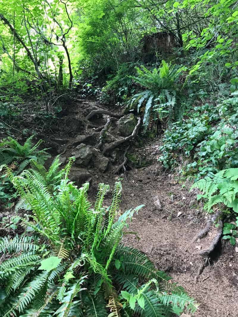
And then there is Elk Mountain, whose steepness I struggle to explain. It’s barely even a trail in the traditional sense — more like a way up the ridge, which involves climbing over roots and rocks, dealing with slippery slopes, trying not to look down (scary) or up (discouraging) but rather just staying at it, believing it will end well.
You want the numbers? Start at Elk Creek Campground off Highway 6, and it’s 1,900 feet in 1.5 miles – well steeper than Dog, and infinitely rougher.
But that’s just to Elk Mountain!
Trek With Me to Mt. Everest Base Camp in April 2018
Once you have climbed Elk, I strongly suggest that you not go back down it. It’s heinous enough going up. Instead, follow the trail another 1.5 miles — up and down, all around, and gaining another 200 feet in net elevation — to a junction with the Elk Creek Trail. That one descends four gradual (and not too exciting) miles back to the trailhead and campground. The last bit follows the creek, which is nice, and which you will want to soak your feet in.
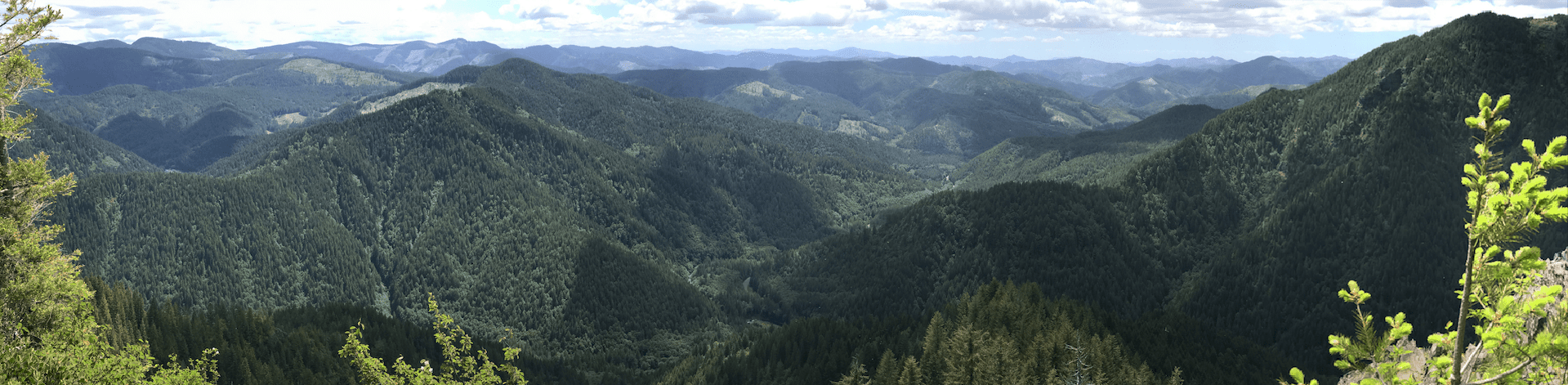
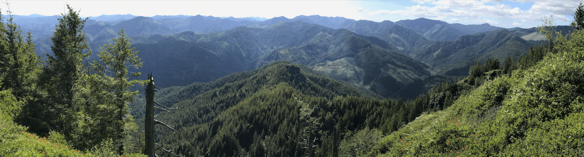
The Elk Mountain to Kings Mountain Loop is something else entirely. First Elk will kick your ass. Then you deal with the ups, downs and all-arounds to get to that junction. Then you have a nice traverse on an old road, with flowers all around. Then you start the ups and downs again, but this time with even more exposure to mildly terrifying drops.
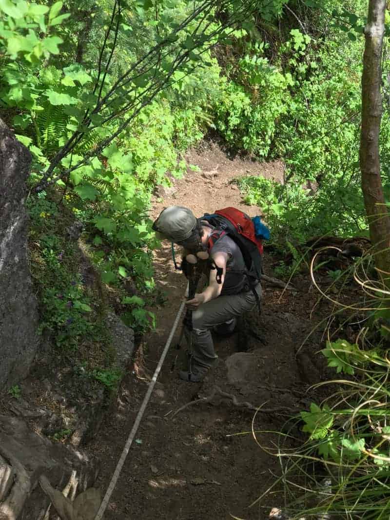
And then you get to the rope.
The rope was put in by the Mazamas, a local climbing and hiking club that has adopted this trail for maintenance. The rope is on a narrow, steep, slippery, exposed section of trail where without the rope you … don’t want to think about it. The best way to use the rope is to hold onto it and walk backwards down the hill — and yes, this is an improvement!
And then you go up and down, super steep, some more until you get to Kings Mountain. I am already starting to block out the details from my memory.
The flowers start up here in March, and when I did this on June 4, 2017, there were paintbrush everywhere, along with phlox and the first beargrass of the season.
The views are nice, if not up to Gorge or Mount Hood levels. This remains a working forest, which means you’ll see lots of younger trees, some clearcuts, but plenty of hills and no obvious sign of development. It is also the scene of historic, massive fires from the 1930s to 1950s.
Get A Signed Copy of 60 Hikes or One of My Other Titles
Enjoy your time on Kings, and prepare to miss going uphill.

Coming off Kings is another exercise in steep, but at least this time you’re going down, in the shade, on a real trail. And through some of the most impressive stands of sword fern I suspect you will ever see.
This is a hike that you will want do as a car shuttle. Otherwise, when you have gone from Elk Creek Trailhead, up and over (and up and over, and up and over) to the Kings Mountain Trailhead, you will still have to walk 3.5 miles (generally up) on the Wilson River Trail to get back your car. Screw that. Leave another car at Kings, preferably with a cooler in it. And when you get back to Elk Creek, go soak your feet in the clear, cold water. You deserve it.
Here is my Gaia track, which you can see in full here. I didn’t have good reception from the trailhead to Elks Mountain, but you get the idea. Click the link to check out the elevation changes!
All in all, a fine day — easier said the next morning, after about 36 hours of ibuprofin treatment and 10 hours of sleep. But if hiking yourself into shape is of interest, your legs and lungs will (eventually) appreciate your conquest of the Elk Mountain to Kings Mountain Loop.
For now, here is my photo gallery (click on the first one to scroll through them all):


Read more Portland hiking stuff here. Buy signed books here. Connect with Paul:
-
Twitter (@60HikesPortland)
-
Instagram (pdx.paul.g)
-
“60 Hikes” page on Facebook.
-
Subscribe to the free monthly(ish) e-newsletter
-
I also write about life in a taxi, English soccer, and being in recovery.