


Update: As of January 2018, this trail is closed because of the 2017 Eagle Creek Fire. Check the National Forest website for the latest info.
Heading east on Interstate 84 through the Columbia River Gorge, you have no doubt noticed the rest area called Starvation Creek. You may also know that it’s the trailhead for Mount Defiance, the highest point in the Gorge. Did you know there’s also a pretty easy loop from there that includes four waterfalls and some great views?
In fact, the little parking area hides all sorts of surprises — including one of the Gorge’s best waterfalls just a minute’s walk away — a falls that isn’t mentioned on the highway sign or the parking lot sign. So let’s have a look around, shall we?
Read All My Posts on Columbia Gorge Hikes
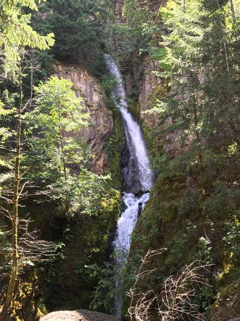
Getting there couldn’t be simpler: Just take the exit and park! It gets crowded on weekends, but most of those people are going on the epic slog up Defiance. Not us — not today, anyway. Instead, start by following the Historic Columbia River Highway beyond the bathroom, over a creek, and eventually to lovely Starvation Falls (right).
Next, head back where you came from, and keep going on the old highway; this is the latest section to be restored for hiker-biker purposes. In just a minute, look for a trail heading up and to the left — and I do mean up.
It’s the Starvation Cutoff Trail, and don’t worry; your day won’t be all like this. Arrive at the Starvation Ridge Trail and turn left, which gets you to a nice view of the Columbia River.
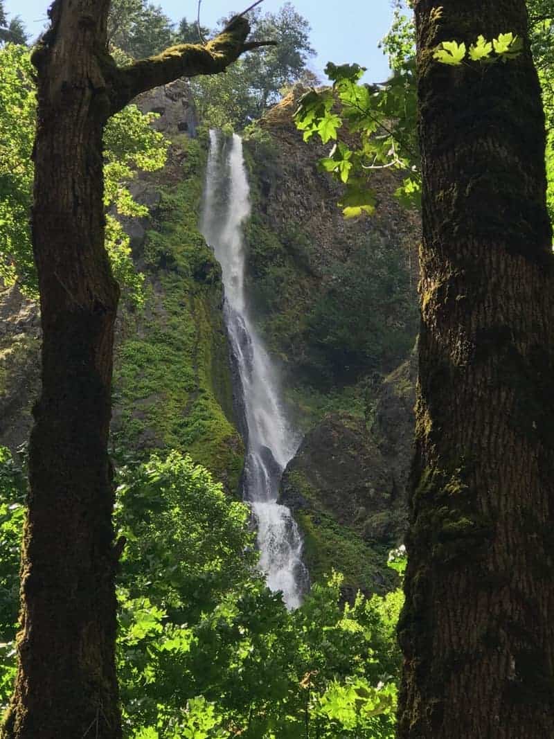
Then head back the other way, past the junction, and eventually pop out at a set of power lines with more great views (such as at the top of this post. Then you drop down, cross a creek, then come to a junction with the Mount Defiance Trail. Turn left here and go a few minutes to check out Lancaster Falls:

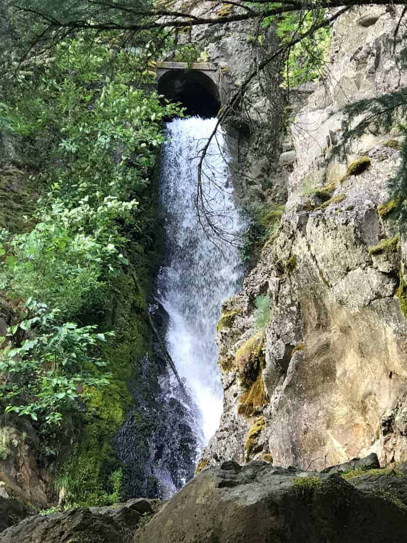
Go back to the junction and this time head down, which soon brings you back to the historic highway near the base of Hole in the Wall Falls. It’s called that because they re-routed it through a pipe to keep it off the old highway.
As you head back down the highway, you’ll pass one more falls, Cabin Creek. All of these are more impressive in the spring, of course; that’s also when those meadows up above will be covered in flowers.
Get A Signed Copy of 60 Hikes Within 60 Miles: Portland or One of My Other Titles
But even if it isn’t spring, this is a nice little leg-stretcher, three miles in all, gaining about 1,300 feet, and visiting four waterfalls in just over a 90-minute walk. There are definitely harder hikes in the Gorge, and plenty of other waterfall hikes around, but I recommend this Lower Starvation Loop.
Here is my Gaia track, which you can see in full here.
For now, here is my photo gallery (click on the first one to scroll through them all):


Read more Portland hiking stuff here. Buy signed books here. Connect with Paul:
-
Twitter (@60HikesPortland)
-
Instagram (pdx.paul.g)
-
“60 Hikes” page on Facebook.
-
Subscribe to the free monthly(ish) e-newsletter
-
I also write about life in a taxi, English soccer, and being in recovery.