


Everybody is rightly excited about Spring and what it means for hiking near Portland: sunshine, wildflowers, and rising snow lines. But there is still rain, and when it combines with that melting snow, the waterfalls near Portland go berserk.
So here are some suggestions for the best waterfall hikes near Portland.
All of these are featured in the new edition of my book, 60 Hikes Within 60 Miles of Portland, which is coming out in May. You can pre-order a signed copy now, or you can get that plus some other cool stuff, by supporting my Indiegogo campaign for Breakfast in Bridgetown. That way, you could get a signed copy of 60 Hikes, a signed copy of Breakfast with your name in the Acknowledgements, and other cool perks.
Okay, on to the best waterfall hikes!
Beacon Rock State Park
- Where: Seven miles west of Bridge of the Gods on WA 14.
- Access: Washington Discover Pass ($10 for a day, $30 for a year) required and can be bought at the park or online at discoverpass.wa.gov.
- Length: 2 miles roundtrip to the falls, 8 to Hamilton Mountain
- Difficulty: Moderate.
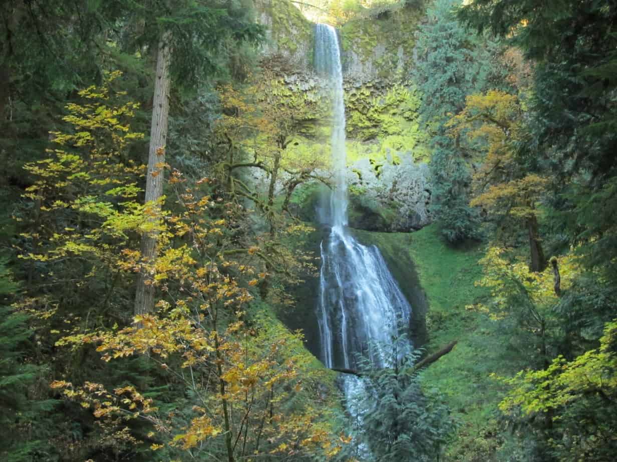
Hamilton Mountain Trail in Beacon Rock State Park is well-known to spring hikers. It’s a tough conditioner with nice views from the top of an 8-mile loop. For our purposes, just go a mile up — sometimes steeply — to a little waterfall cove. First you’ll come to a side trail on the right, leading to a viewpoint of Hardy Falls, then the trail arrives at the falls itself. Follow another side trail up here to Rodney Falls, aka Pool of the Winds, where wind and water blast out of a nook in the rocks. Fantastic on a warm day!
Clackamas River Trail
- Where: Start at Indian Henry, 22 miles past Estacada on OR 224.
- Access: Free
- Length: 6.6 miles roundtrip to Pup Creek Falls.
- Difficulty: Moderate.
Before we go on, parts of this trail are currently closed due to storm damage below Pup Creek Falls; that’s coming in from the other trailhead at Fish Creek. Starting this way, you’ll see more falls, anyway, and not have to pay for parking. Along the way, you’ll pass The Narrows, where the Clackamas passes through a spectacular gouge in ancient lava. You’ll also see many amazing rock formations, side creeks, smaller falls, and have a wet-footed crossing of Pup Creek right before a side trip to the falls.
Wahkeena Trail
Update: As of January 2018, this trail is closed because of the 2017 Eagle Creek Fire. Check the National Forest website for the latest info.
- Where: Start at Wahkeena Falls in the Columbia Gorge
- Access: Free
- Length: 8.2 miles to see it all, but not required
- Difficulty: Tough.
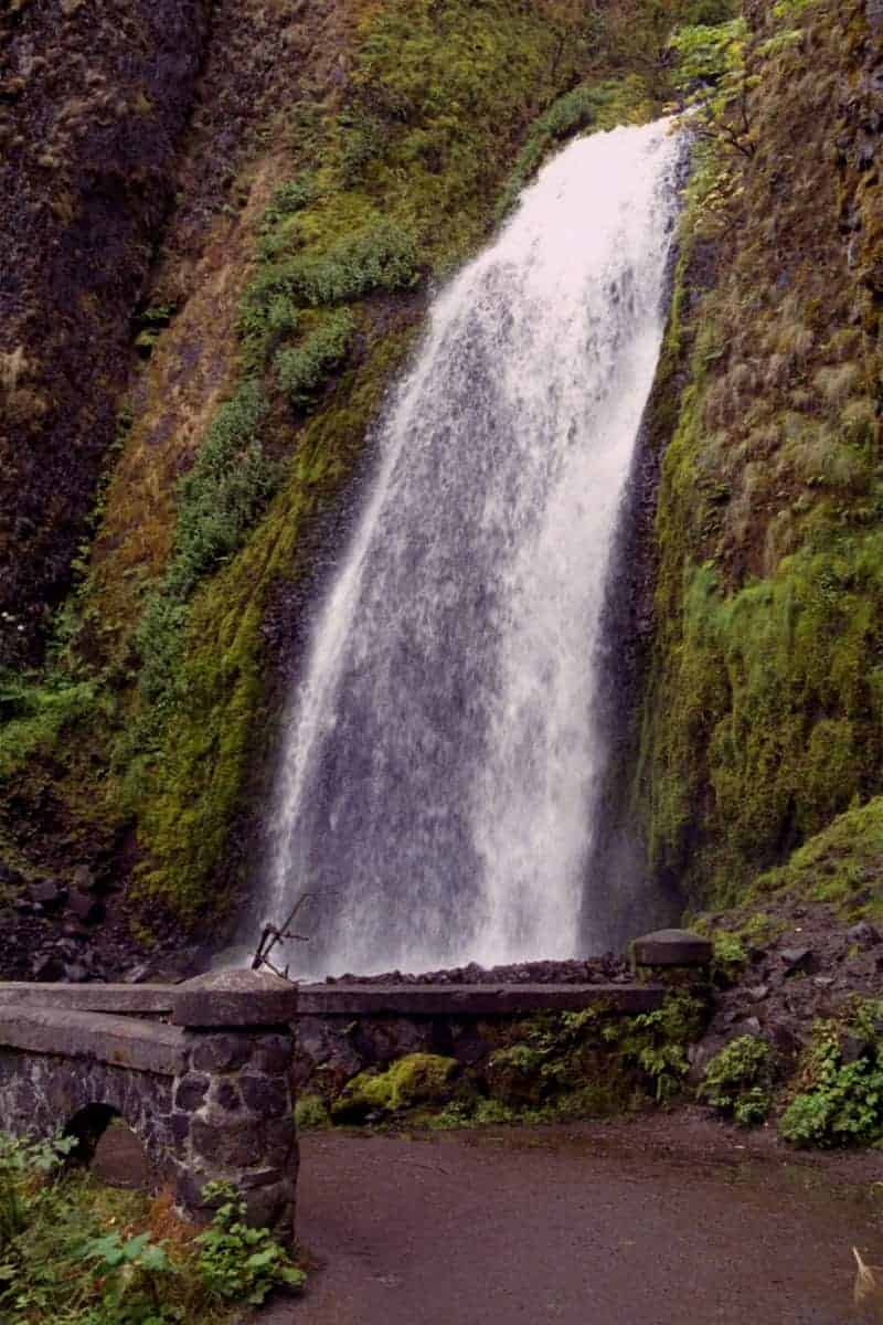
Here’s another one with a closure — in this case, the Benson Bridge at Multnomah Falls. It will re-open for Memorial Day. But if you start at neighboring Wahkeena Falls , you can see that amazing falls with hardly any effort at all. After Wahkeena, it gets pretty intense as you climb the paved path, but beyond that you can ascend the creek through a wooded rocky, splash-filled canyon. You’ll also see lovely Fairy Falls. At the top visit Wahkeena Spring, where the creek pops out of the ground, and maybe put in another couple of miles to the Larch Mountain Trail, where to 50-foot falls await in a gorgeous stretch of trail.
Eagle Creek
Update: As of January 2018, this trail is closed because of the 2017 Eagle Creek Fire. Check the National Forest website for the latest info.
- Where: Just past Bonneville Dam on I-84.
- Access: Northwest Forest Pass; $5 per day or $30 per year.
- Length: Anything you want, up to 13 miles roundtrip.
- Difficulty: Moderate.
Note: As of March 21, 2017, Eagle Creek Trail is closed at mile 3.1 due to a landslide. There are still some nice falls in that stretch, but keep an eye on the Forest Service Website for up-to-date info.
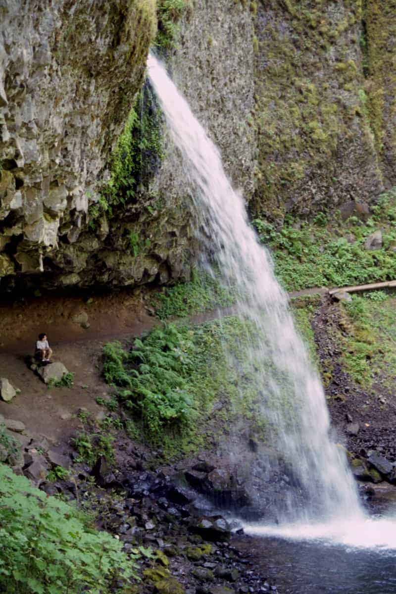
You probably know all about this hike, but maybe you’ve only done it in summer. Well, now is the best time to do it, because there are waterfalls everywhere! Water literally crashes down the side of this lovely canyon at dozens of places in winter and early spring, and just about every step is magical — but some are dangerous, as well. Beware ledges and lingering snow. Make sure you go at least two miles up, to see Metlako Falls (at 1.5 miles) and Punchbowl Falls (2 miles) from above and from a side trail to its base. Beyond that is pure waterfall heaven, all the way to Tunnel Falls (6) and “Criss-Cross Falls” (6.5).
Triple Falls
Update: As of January 2018, this trail is closed because of the 2017 Eagle Creek Fire. Check the National Forest website for the latest info.
- Where: Just past Multnomah Falls on the Historic Columbia River Highway
- Access: Free
- Length: 4.5 miles roundtrip to Triple Falls
- Difficulty: Moderate.
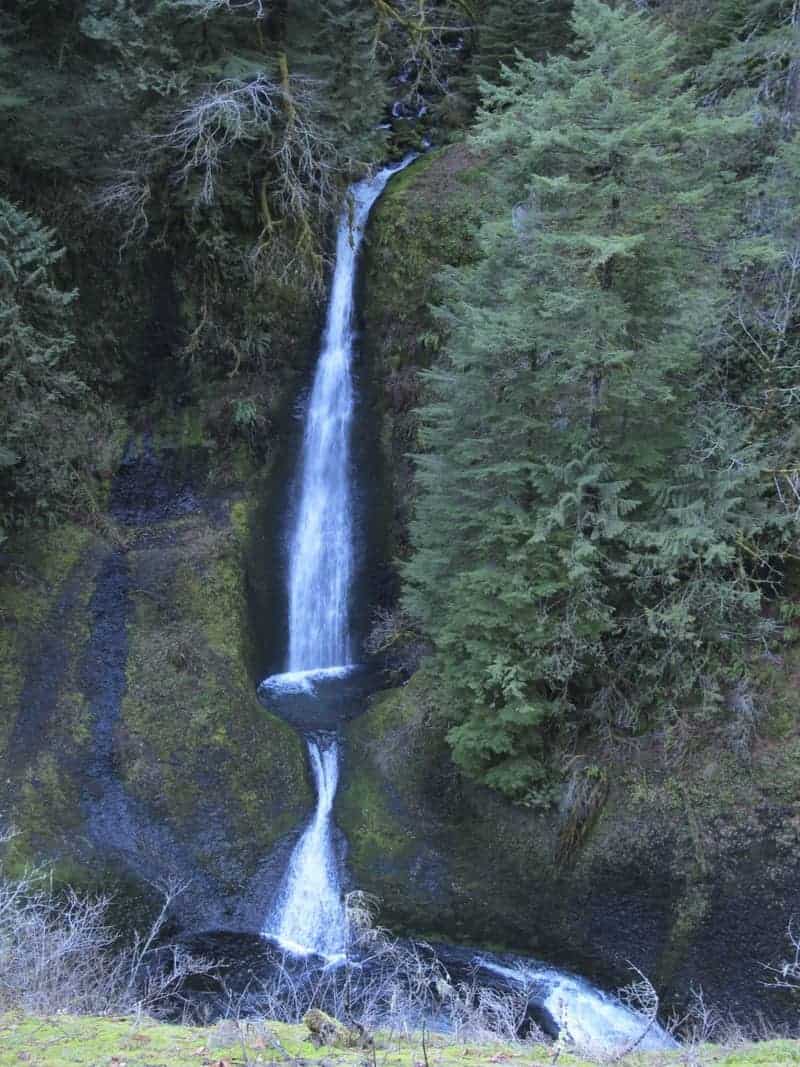
This one is almost like cheating, since you can see a nice waterfall without leaving the parking lot. Horsetail Falls is the starting point for this one, and after a little climbing away from there, the trail flattens out before passing behind Ponytail Falls, hardly a quarter-mile in. A mile past that, you cross the head of Oneonta Gorge, where a nice falls is just above the trail, and another mile up you’ll see Triple Falls itself. It’s really one creek (Oneonta) split in three, and a nice new bridge lets you cross just above it to a nice resting area beyond.
Siouxon Creek

- Where: Out past Battle Ground in the Gifford Pinchot National Forest.
- Access: Free
- Length: 10.8 miles roundtrip to see it all
- Difficulty: Easy to Moderate.
Somehow, this piece of ancient forest never got cut, even though everything around it did. Siouxon (pronounced SOO-sonn) is a magical place of (mostly) easy hiking, big trees, lovely creek, campsites, and waterfalls. Highlights include Siouxon Falls at one mile, a side trail to Horseshoe Creek Falls at 1.4, and Chinook Falls at 4 miles — but that’s right after a tricky creek crossing. Cross Chinook Creek and turn left for a 1.4-mile roundtrip to 100-foot Wildcat Falls.
Silver Falls State Park
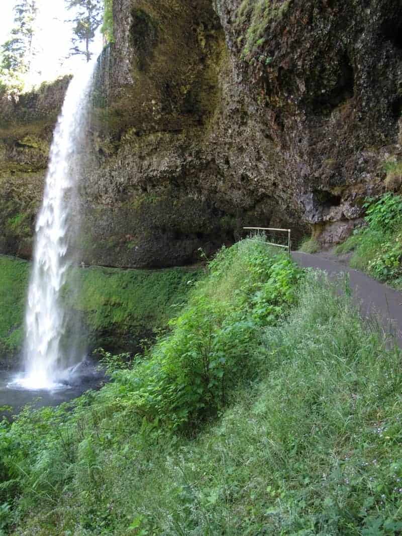
- Where: 15 miles past Silverton on OR 214.
- Access: $3 parking fee per vehicle.
- Length: Anything up to 7 miles
- Difficulty: Moderate.
This is the biggie in Waterfall World around here. The name kind of says it all: The Trail of 10 Falls. Any questions? Start with the biggest of them all, 177-foot South Falls, just a minute’s walk past the visitor center. After passing behind South Falls (and no doubt getting wet), you have nothing but options. If you’re up for a seven-miler with not much elevation gain, you can see (and go behind) 93-foot Lower South Falls and many other highlights. Maybe the best view of all is North Falls, which you can access from a separate parking lot on OR 214.
Read more Portland hiking stuff here. Connect with Paul:
-
Twitter (@60HikesPortland)
-
Google+
-
“60 Hikes” page on Facebook.
-
Join a hiking trip to Nepal or Europe
-
Subscribe to the free newsletter
-
Check out my new English Soccer Project