


As I keep working on updating my book, 60 Hikes Within 60 Miles of Portland, this week I got out to one of the best hikes in the Columbia River Gorge: Hamilton Mountain.
It’s a hike that pretty much has it all: easy access, gradual ascent, scenery along the way, two nice waterfalls, a view on top, and a loop option that only adds to the scenery. So it is definitely one of my favorite springtime Gorge hikes. Since it’s south-facing, it gets more sun than the Oregon side, so it has flowers when some places in Oregon are still covered in snow.
The hike is in Beacon Rock State Park, just a few miles west of Bridge of the Gods. There is a $2 toll each way on the bridge, and you’ll need a Washington Discover Pass to park at the trailhead; that’s $10 for a day and $30 for a year, and you can pay with cash at the trailhead or with a card down at the highway entrance.
Related: What are the best waterfall hikes near Portland?
One cool feature is that pretty early in the hike, you get a view to where you’re going. This is also where you might literally feel the heat, as you’re passing under power lines and lose your shade for a bit. Back in the trees, you will keep climbing, at an occasionally annoying pitch, on a wide and packed trail.
Just 1.5 miles from the car, you’ll come to a side trail, leading right, to a view of Hardy Falls a short distance below. Back up on the main trail, you soon come to Rodney Falls. Detour to the top for the famous “Pool of the Winds,” where the creek goes into a rock bowl and comes blasting out — a nice refresher if it’s a warm day.
I have a few shots of the falls in my gallery below, but here is a video from my Youtube Channel:
Just past the falls, there is a super muddy section, where the trail was wiped out in the winter of 2016-17.
An 80-foot Douglas Fir fell, tearing apart the trail on a steep slope, and a section of another fell and stuck in the ground like a spear, three feet deep. They had to haul equipment up here, dig out the root ball, unplug the spear, and then start all over, building what you see now. It’s quite a story, which the Mazamas tell on their blog. It’s also quite a mud pit at the moment.
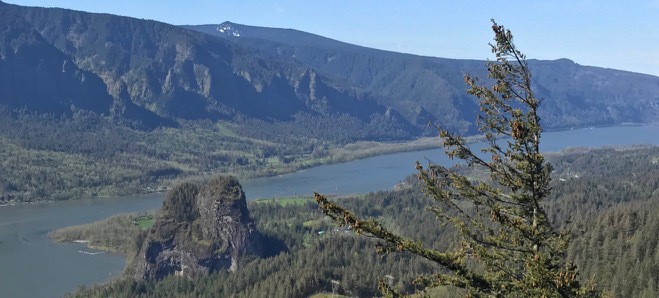
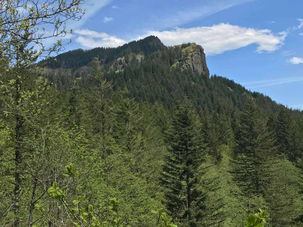
Now you keep climbing to your next built-in rest stop, a rocky outcropping about halfway up the hill. It can be dangerous, so don’t get goofy out there, but the views are pretty cool, from Bonneville Dam to Beacon Rock and on down the Columbia:
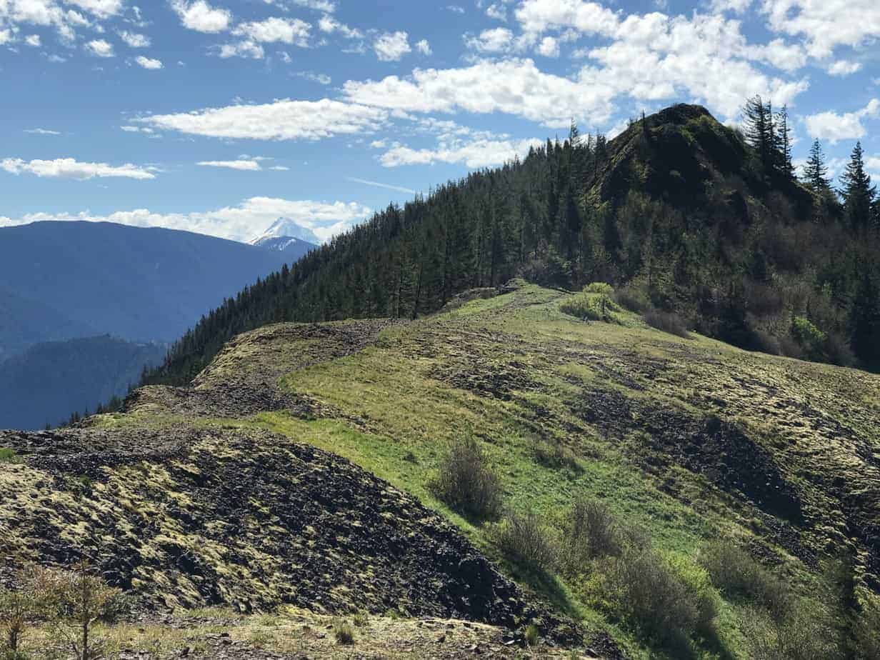
Then it’s just a bunch of switchbacks to the summit, passing the big cliffs on the north face of the peak and emerging ever more into the sun and flowers. It’s an amazing part of the trail, unless you’re completely out of shape and thinking you should get a job other than driving a taxi.
All told, we put in 7.1 miles, gaining just under 2,000 feet. Here is my Gaia track, which you can see in full here.
We looped around the north side, with its views of Adams and Hood, then down through the woods along Don’s Cutoff to a picnic table by Hardy Creek, where we ate our lunches, then looped back to the main trail and to the cars. And then, because it was a warm weekday (lucky us) and it wasn’t too crowded (super lucky us) we cooled our feet in the Oneonta Gorge:
And now, here is the photo gallery:


All in all, a fine day, and one I recommend — especially if you can get out there on a weekday and/or early in the morning. We hit the trailhead at 8:30 on a Thursday morning, and there were already 8 or 10 cars in the lot. When we got done at 12:30, it was almost full!
Read more Portland hiking stuff here. Connect with Paul:
-
Twitter (@60HikesPortland)
-
Instagram (pdx.paul.g)
-
“60 Hikes” page on Facebook.
-
Subscribe to the free monthly(ish) e-newsletter
-
I also write about life in a taxi, English soccer, and being in recovery.