


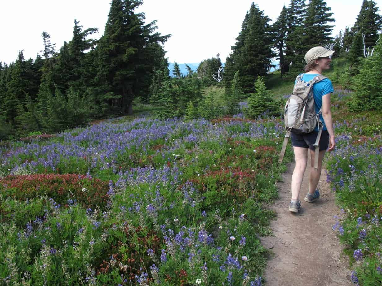
It is absolutely prime season for hikes near Mount Hood. Right now, the flowers are blooming all over the place, the weather is perfect, the bugs are dying off … all in all, if you’re looking for a Mount Hood hike, now is the time. And McNeil Point is the place.

And in my opinion, there’s no better hike than the trek up to McNeil Point. In fact, now that Vista Ridge is burned up, McNeil might be my favorite Mount Hood hike. Here’s a brief writeup about it; for more, see my book, 60 Hikes Within 60 Miles of Portland.
Why You Should Go
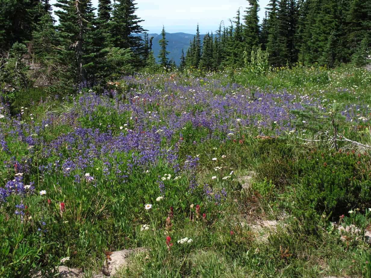
Vista Ridge is fascinating specifically because it all burned up, and the meadows up there are still amazing, but McNeil has it all: old forest, babbling brooks, wildflowers, meadows, awesome mountain views, and even the chance to get right up close with a glacier.
And honestly, it’s not all that hard. Even if you push on to the point and above – and you’ll see plenty of beautiful stuff, even if you don’t – you barely gain 2,200 ft. over about five miles getting there. This hike rarely even approaches being “steep” the way I do it.
[quote]old forest, babbling brooks, wildflowers, meadows, awesome mountain views, and even the chance to get right up close with a glacier.[/quote]
The Stats
I used to show this the same as everybody else: about 9 miles roundtrip. On this last hike my GPS showed 10.2 miles roundtrip, and based on how long it took, I tend to believe that. Anyway, the elevation at Top Spur Trailhead is 3,960 feet; the ponds, a little over 4 miles up, are at 5,500 feet. The highest point on the hike, just before the shelter, is 6,100. At my standard pace – walking 2 mph, making 1.5 including breaks – this hike took about 6.5 hours.
How to Get There
Here are the normal directions:
Take US 26 from Portland, driving 36 miles east of I-205 to Zigzag, and turn left onto Lolo Pass Road at the Zigzag Store. Go 10.6 miles to Lolo Pass and make a right onto the paved FS 1828, which is the first right at the pass. Go 3.1 miles and turn left onto the gravel FS 118, following a sign for Top Spur. The trailhead is 1.5 miles ahead on the right.
But Lolo Pass Road is closed through Labor Day. You have to take a detour after taking the left off US 26. Check the Mount Hood National Forest website for details.
The Hike
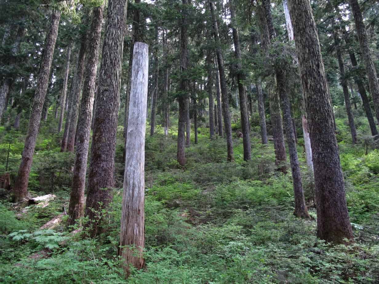
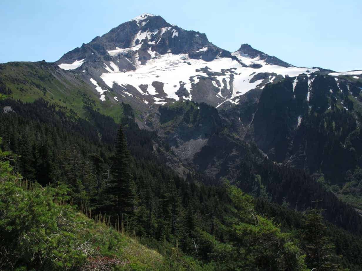
[twocol_one]Things start out nice and mellow, in a cathedral-like forest, as you climb half a mile to the Pacific Crest Trail. Turn right there, then at the four-way junction stay straight on the Timberline Trail for the awesome view of Mount Hood from Bald Peak:
[/twocol_one] [twocol_one_last]Shortly after this, duck through the woods on a left-hand trail to rejoin the Timberline Trail, climbing through the forest. You’ll pass a couple of meadows with more views of Hood, then enter the High Country of creeks, flowers, meadows and ponds.
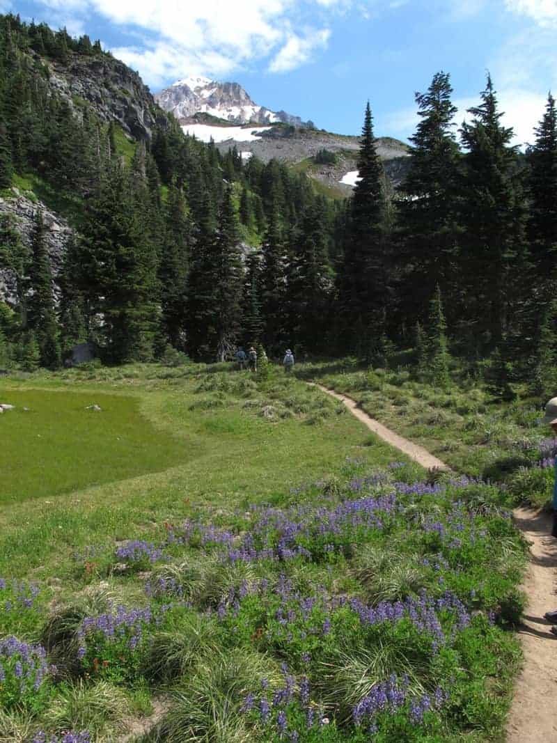
[/twocol_one_last] At about 4 miles up, you’ll see the trail headed right to McNeil Point, following a small ridge and then crossing rocks and, perhaps, some snow – all this among blooming heather and wildflowers. At a Y junction, stay right to reach the 1930’s era stone shelter at McNeil Point, with, yes, even more amazing views.
[twocol_one]

[/twocol_one] [twocol_one_last]
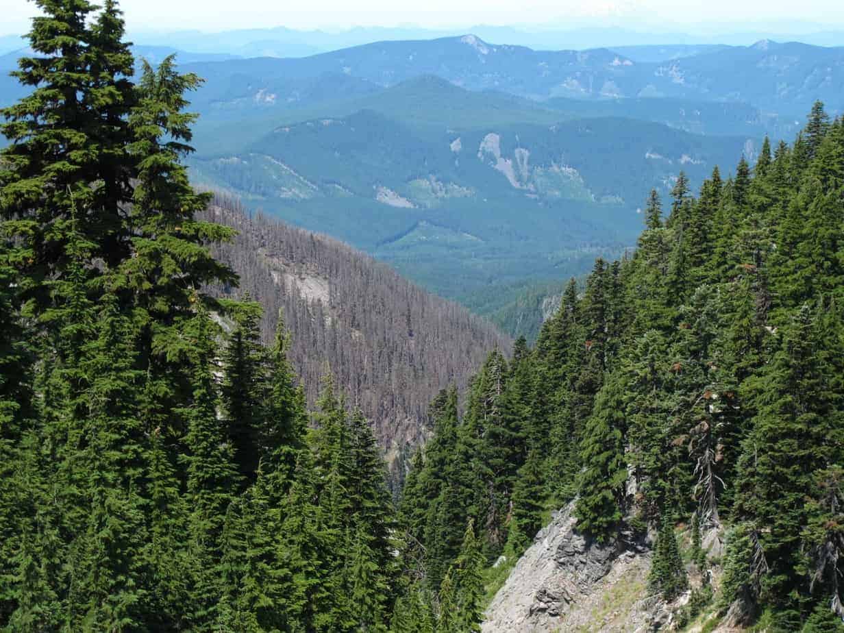
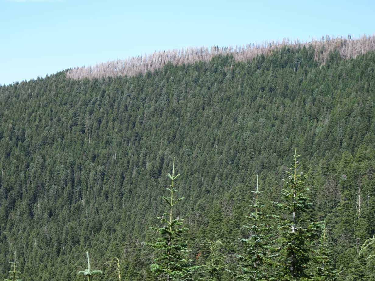
[/twocol_one_last]One interesting aspect of this hike is that you can look down onto the results of a recent, massive forest fire: the 2011 Dollar Fire, which really toasted the Vista Ridge hike. From McNeil and the trail to it, you can see the contrast between when burned and what didn’t, and see the vagaries of fire boundaries.
[twocol_one]
[/twocol_one] [twocol_one_last]
[/twocol_one_last] From McNeil Point, you can follow a user trail above this for even higher country, and eventually get out between the glaciers, but don’t go on those unless you clearly know what you’re doing and have the right gear.
See what I mean about a honey of a hike? Great forest, classic view without much trouble, shortcuts, meadows, ponds, creeks, and killer views all over the place. There’s no other way to say it; it’s a honey of a hike!
Follow me on Twitter (@60HikesPortland) or Google+, or like the “60 Hikes” page on Facebook.
I don’t just hike, though: I’m also the Portland Breakfast Guy. Check out BreakfastinBridgetown.com.
[schema type=”review” name=”Best Hikes near Mount Hood: McNeil Point Hike” description=”a 10.2-mile roundtrip hike through forest, flowers, meadows and views.” rev_body=”McNeil Point is one of the prettiest, most dramatic hikes on Mount Hood. Especially in late summer, when the flowers are blooming, you can’t find a better place to go hiking.” author=”Paul Gerald” pubdate=”2013-08-28″ user_review=”9″ min_review=”1″ max_review=”10″ ]
[…] to McNeil Point instead — but get there early. And remember that part of Lolo Pass Road is still closed […]
[…] and the cool of fall, so pick a hike and go for it. I recommend something on Mount Hood, like McNeil Point, or near there, like Lookout […]