


Update: As of January 2018, this trail is closed because of the 2017 Eagle Creek Fire. Check the National Forest website for the latest info.
If you want to know what hiking in the Pacific Northwest is all about, it comes down to three things: mountains, oceans, and forests filled with waterfalls. For that third category, I can’t imagine there’s a better hike than Eagle Creek in the Columbia River Gorge.
I live in Portland, and I get to Eagle Creek at least once a year. But every time, I am amazed as if I’d never been there. I don’t think my mind can retain the beauty of the place, so that every spring, when I venture out at peak times for green leaves, abundant water and (relatively) small crowds, my little human mind gets blown all over again.
The trail was built in 1915 and 1916, to coincide with the opening of the Columbia River Highway. And the area which now hosts a fish hatchery and the trailhead was, in 1916, the very first National Forest campground, with 100 spots catering to as many as 2,000 people per day. That was replaced in the 1930s, when Bonneville Dam was built, by the Civilian Conservation Corps.
Also during that time, the highway was routed into a new Toothrock Tunnel that you passed through driving out from Portland, just before taking Exit 41/Eagle Creek. That replaced the famous Eagle Creek Viaduct; the highway used to wrap around Toothrock in a section just visible in the trees above the off-ramp from I-84, then drop via the viaduct to the stone bridge here. The staircase, which replaced the viaduct, is part of the hiker-biker Historic Columbia River Highway Trail. The bridge you crossed over is original from 1916, when this was the end of the road from Portland.
Read All My Posts on Columbia Gorge Hikes
The Eagle Creek Trail goes 14 miles up to Wahtum Lake, where it connects with the Pacific Crest Trail and the Herman Creek Trail, but on this hike we did a 7.2-mile out-and-back to High Bridge. That includes a brief side trip to Lower Punchbowl Falls, but the whole hike only gained a smidge over 700 feet of elevation. It’s one of the beauties of the hike; incredible scenery without much effort. (Hence the crowds.)
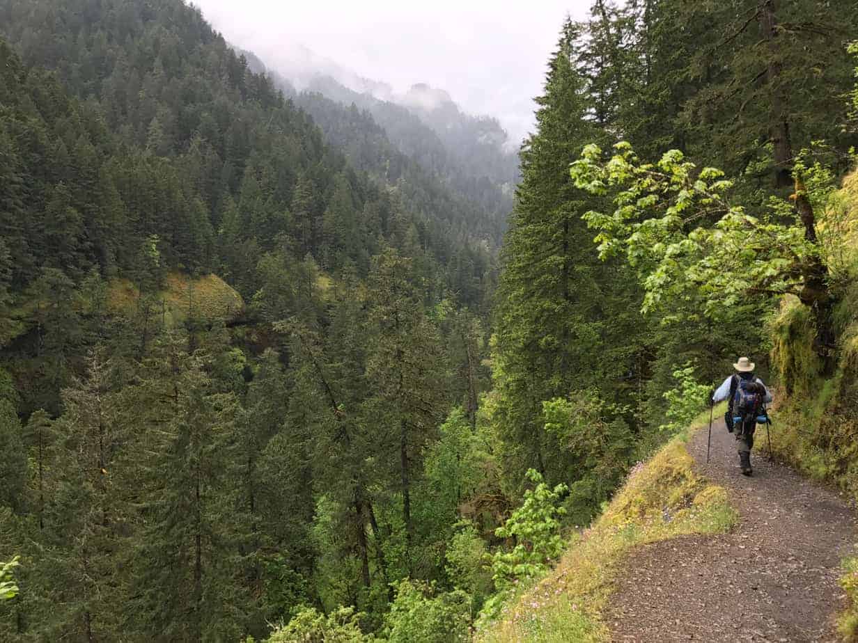
Two things to keep in mind, though: People with a fear of heights should stay away from this trail, and in the spring you will likely get your feet wet on at least one creek crossing. Also, don’t leave anything valuable in your car, and make sure you have a Northwest Forest Pass.
Otherwise, it’s really straightforward, as there are no junctions other than the well-marked trail down to Punchbowl. The scenery, and the waterfalls, being right from the trailhead. And try to keep in mind, as well, the effort it would have taken to build this thing over 100 years ago — blasting into the cliffsides, with men rappelling down from above — plus all the effort it takes to maintain it today.
And speaking of maintenance, I was leading this hike as an educational outing for Trailkeepers of Oregon, whose Board I am on. And by happy coincidence, we bumped into a couple of crews from the Pacific Crest Trail Association, who were working with employees of Keen Footwear to clear some rocks and put in drainages. All hail to the trail tenders!
You’ll cross a small footbridge jus over 0.1 mile, then just after that notice that a big section of the wall seems to be missing; it slid in 2007, and a hanging 15-ton boulder had to be blasted out so it wouldn’t crush the trail and hikers. In the first mile you will also pass a “weeping wall” of mini waterfalls and climb into the first area with handrails along spectacular cliffs.
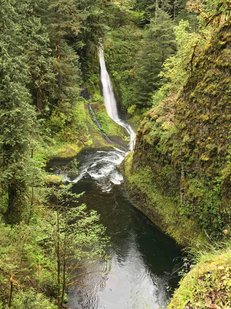
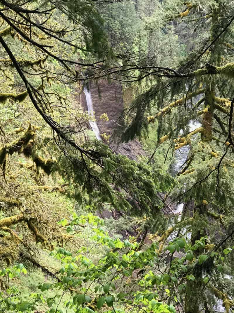
At 1.4 miles, we used to say take the trail to the viewpoint of Metlako Falls, but it’s gone. No, really; the whole trail, the whole viewpoint, slid into the creek this past winter. We are told by the hatchery folks that it stopped the creek for 45 minutes! If you keep an eye out through the trees on the right, you can see where it used to be; signs now mark the former trail — stay on the current one!
Just under two miles, take a side trail down to Lower Punchbowl Falls, and if the water is low (not in spring!) wade out into the creek to look into the more famous Punchbowl Falls. You’ll also see it from above on the main trail very soon.
At two miles cross the new Tish Creek Bridge, flown in here by helicopter (at a cost of $110,000) to replace one taken out by a falling tree, and a mile or so after that, cross High Bridge. the destination for this walk.
Here is a video (from my Youtube Channel) which I shot on High Bridge:
That just doesn’t do justice to the place, but I had to try. Get up there soon — just try really hard to go during the week, or if you have to go on the weekend, go early or late to avoid the crowds. Summer weekends here truly should be avoided.
Here is my Gaia track, which you can see in full here.
I could go on and on about Eagle Creek, but I’ll spare you — at least until I return for another shot at it.
For now, here is my photo gallery (click on the first one to scroll through them all):


")


Read more Portland hiking stuff here. Connect with Paul:
-
Twitter (@60HikesPortland)
-
Instagram (pdx.paul.g)
-
“60 Hikes” page on Facebook.
-
Subscribe to the free monthly(ish) e-newsletter
-
I also write about life in a taxi, English soccer, and being in recovery.