


I might have a new favorite place to go hiking on Mount Hood.
It’s beyond Ramona Falls, which everybody knows about, but hardly anybody goes to this place; and it’s a long walk, which not everyone will want to do. But the solitude, remoteness and beauty of Yocum Ridge gave me a bit of that old hiking magic the first time I did it. What I mean is that I got past being jaded about hikes, wandered into some little-seen country, and felt the awe and wonder that brought me out to the hills in the first place. And now I want to encourage you to check it out, as well.
Yocum Ridge — The Basics
- LENGTH: 15.4 miles to the viewpoint described here. There’s more up above.
- CONFIGURATION: Out-and-back
- DIFFICULTY: Hard because of the length, but rarely very steep. Total elevation gain is 3,100 feet.
- SCENERY: Woods, a beautiful waterfall, meadows, and a sweeping vista
- EXPOSURE/RISKS: In some areas, the trail is along a steep hillside; at the top is a cliff.
- TRAFFIC: Heavy to Ramona Falls, light beyond that.
- TRAIL SURFACE: Sandy to Ramona Falls, then a great tread of dirt and pine needles.
- HIKING TIME: 8 hours
- DRIVING DISTANCE: 53 miles (1 hour, 10 minutes) from Pioneer Square — same trailhead as Ramona Falls
- SEASON: Typically July through mid-October, because of snow
- BEST TIME: Any clear day
- BACKPACKING OPTIONS: Sites at Ramona Falls and up on the ridge.
- ACCESS: Northwest Forest Pass required.
- WHEELCHAIR ACCESS: None
- MAPS: Green Trails Mount Hood
- FACILITIES: Outhouse at the trailhead; otherwise, use the one at Zigzag Ranger Station
- INFO: Zig Zag Ranger District, 503-622-3191.
Getting There
It’s the same trailhead as Ramona Falls. Got to Zigzag on Highway 26 and turn left onto Lolo Pass Road. After 4.2 miles turn right at a sign for “Campgrounds and Trailheads,” then cross a bridge on the right after 0.7 miles, and go another 1.7 miles to take a left onto Spur Road 100. Follow that for 0.5 mile to the sprawling trailhead. Note: This is not a safe trailhead for your car. Don’t leave anything valuable in it. There have been many break-ins here.

The Hike
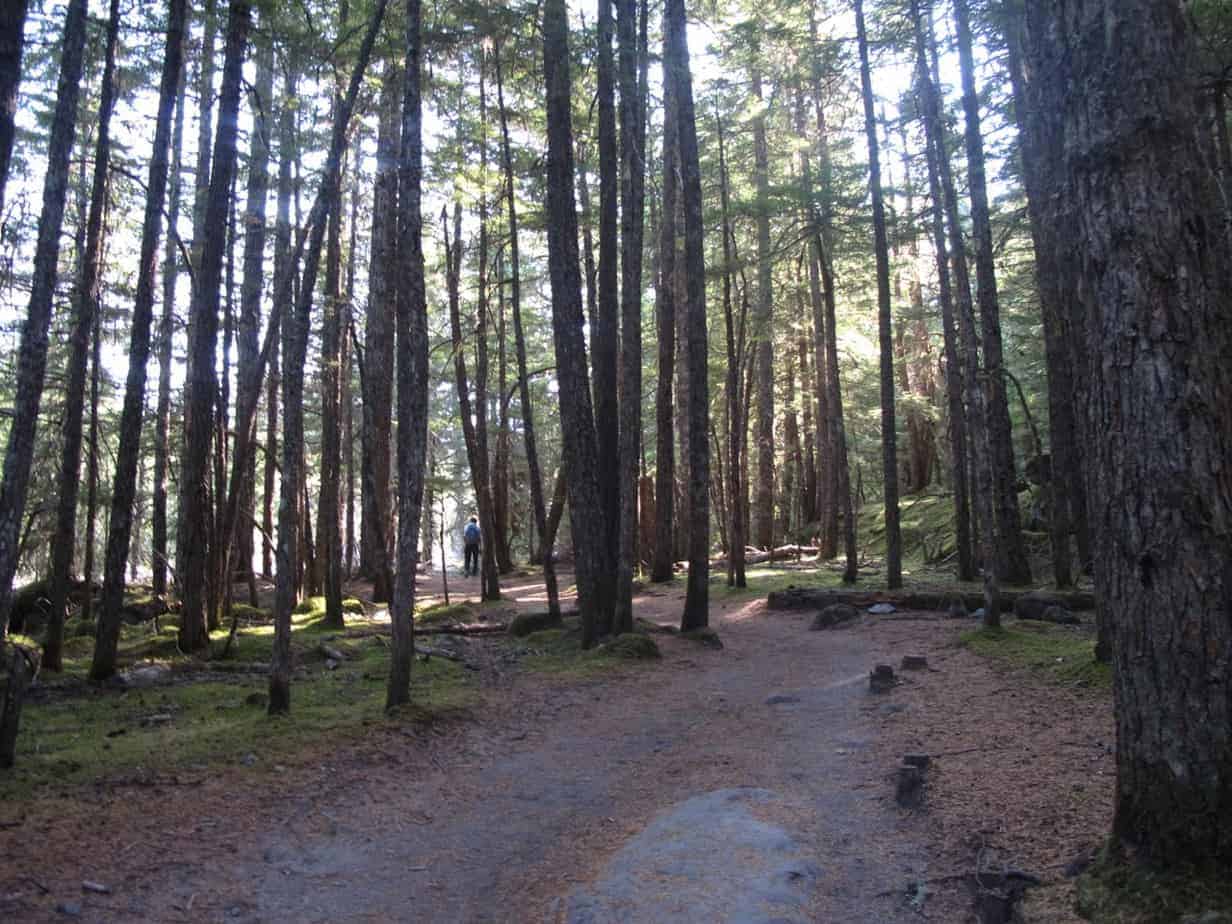
You start out just like you’re going to Ramona Falls, which in fact you are. This means you’ll probably start among crowds of people — hordes if it’s a weekend. You’ll also have a wide, sandy trail leading along the Sandy and through the woods.

Note, in the picture above, the mini gorge created by a flood in November 2007. Before that flood, the river was up at the level where you stand now — and, in fact, at times you can see where the old trail still exists on each side of the cut. So much mud and rock came down so fast that it scoured this gully out — and also removed a bridge and a few houses downstream.
Did you know I lead hiking tours in Europe?
2016 trips include the Cotswold Way in England
and a tour of Tuscany like this one from 2015.
Another high-water event, in the fall of 2014, took out the Forest Service’s seasonal bridge and drowned a hiker. Since then, the Service isn’t putting in that seasonal bridge at all. So you’ll have to cross on one of these logs that were also sprawled around by the bigger flood.
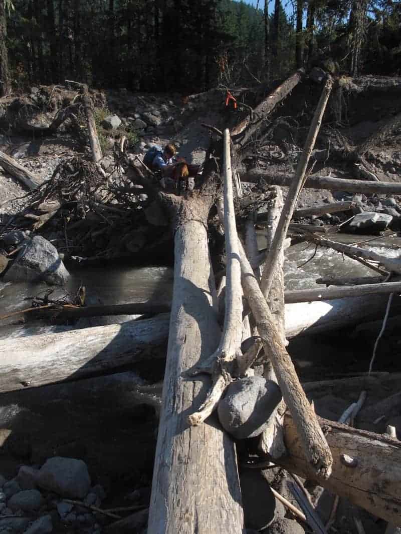
The log crossing is no big deal now — assuming the log is dry, the water is low, and you have a decent sense of balance. You could also wade the river, but I don’t recommend that, since it’s cold, fast and murky.
This crossing, by the way, is 1.2 miles up from the trailhead. When you’re not looking at the river, you’ll be in a forest which, due to all the floods that occasionally wipe it clean, has lots of young trees — but is nice, anyway.
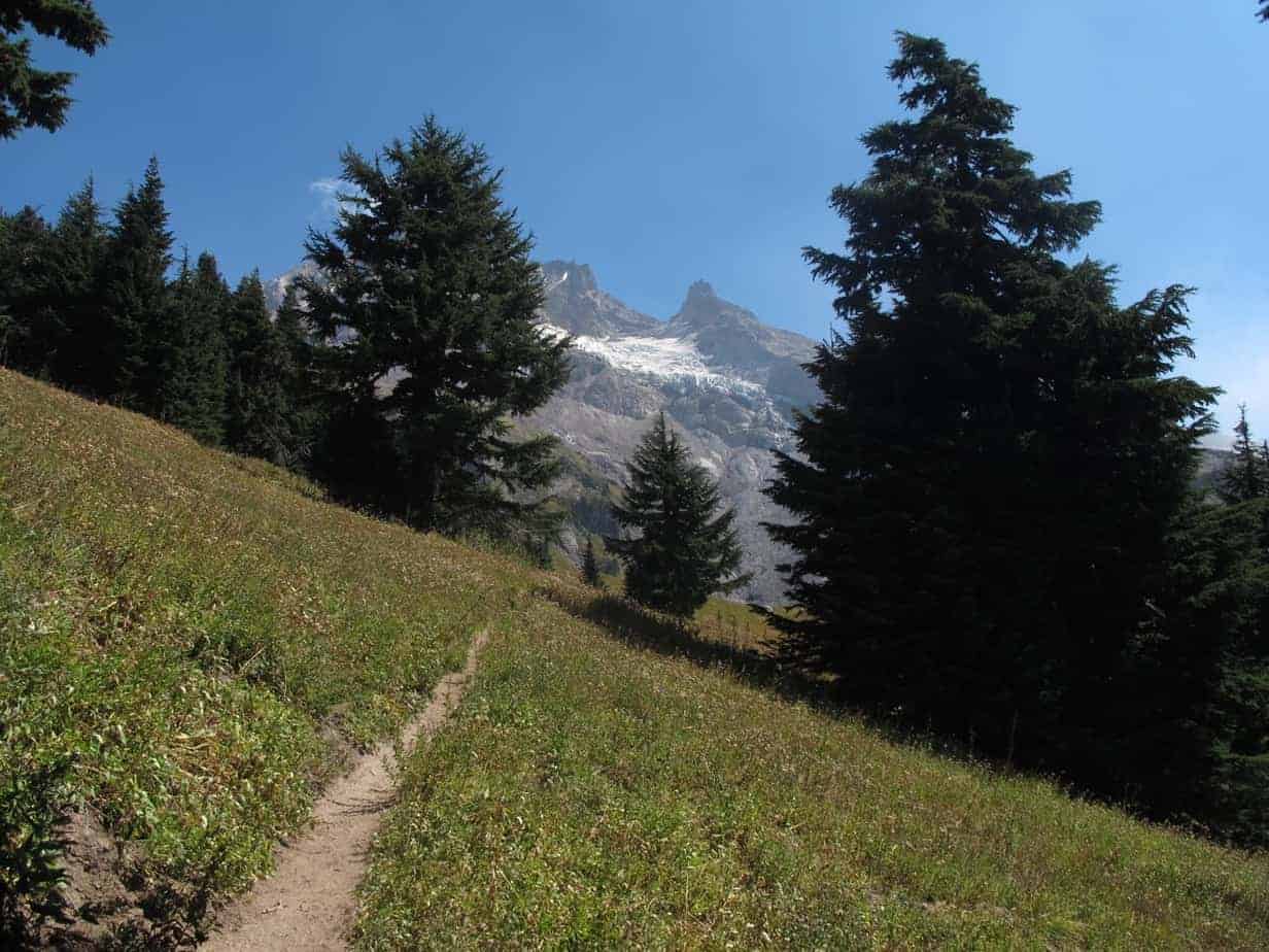
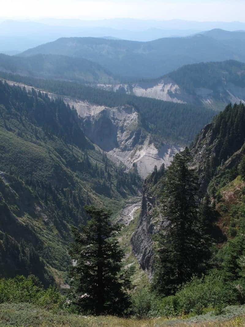
Across the river, follow the trail to the PCT, then turn right. In a mile, you’ll start to hear the Sandy below on your right, and after 1.5 miles the PCT will cut off to the right to cross it. It’s worth going down there to take in the views up the Canyon of Hood — and where you’re going!
This hike, and 59 others, is covered in detail in my book, 60 Hikes Within 60 Miles of Portland.
Staying left at that junction, you will soon see Ramona Falls through the trees.
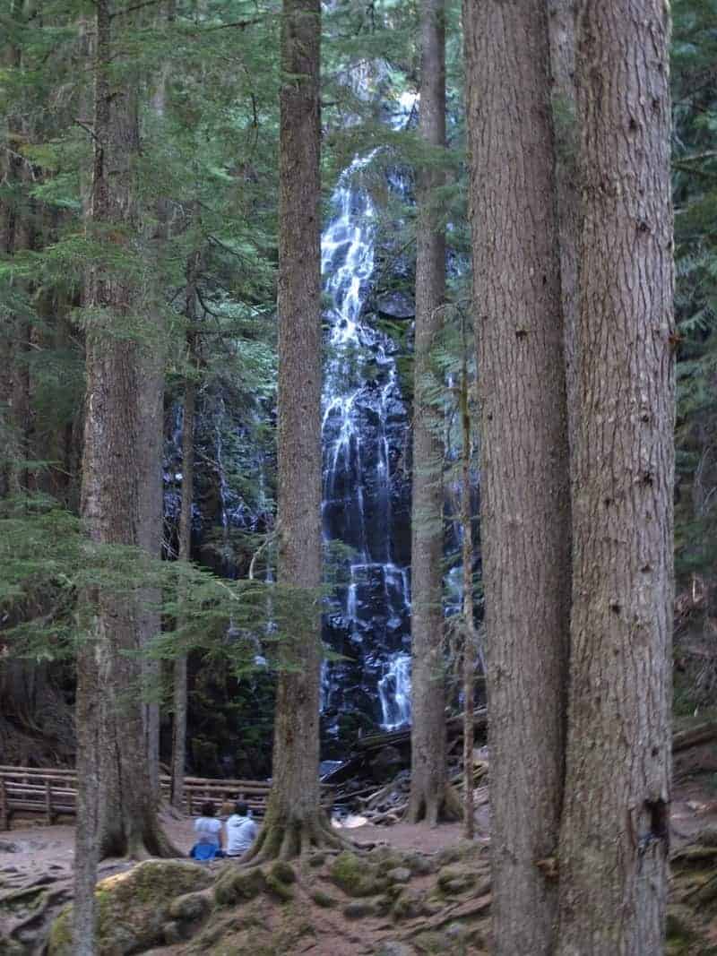
Then the trail goes right in front of it. It’s famously hard to get good pictures of Ramona, mainly because of light, but I was there around 9 a.m. and had it pretty good.

And heck, while we’re at it: here’s a video from the bridge:
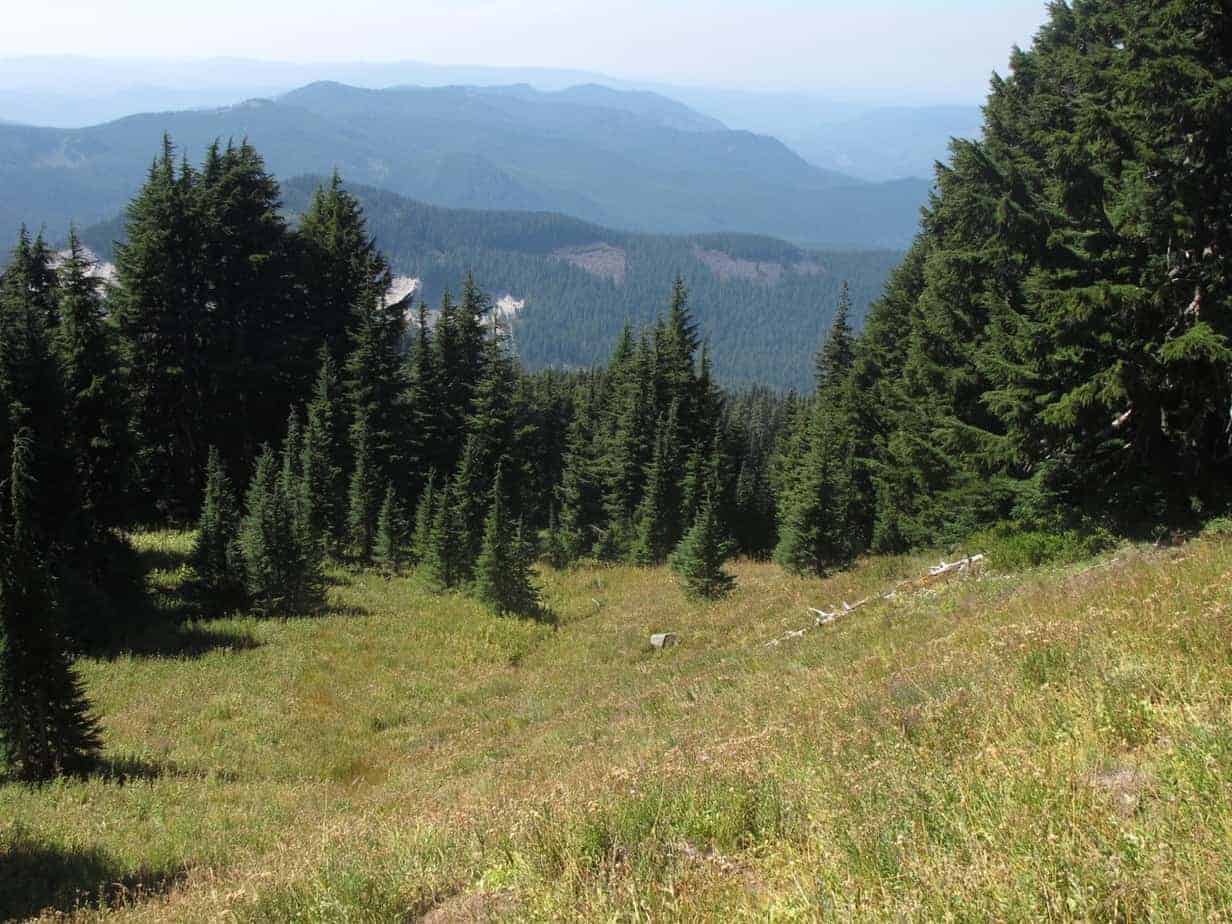
Now for the part that hardly anybody does! Just keep going across that bridge and head uphill and to the right. sticking with the Timberline Trail. After a few minutes of climbing there, head uphill and to the right again, on the Yocum Trail. Now you’ll climb several long, mildly steep switchbacks. Note that I didn’t say “steep,” but I did say “climb” and “long.” From the trailhead to the Falls is two hours, and from there to the viewpoint is another two. The average elevation gain above the Falls is about 600 feet per mile. And there are always some decent-sized blowdown trees to negotiate:
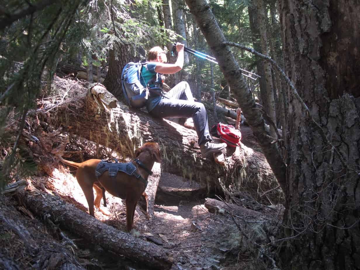
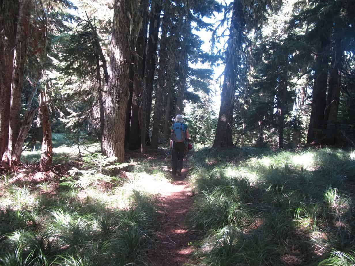
There’s not much to say about this upper stretch, except it can be a bit of a slog at times. But those long switchbacks mean the grade is way cool, and other than the blowdowns, it’s a (long) piece of cake.
And then the trees start opening up, and it’s showtime! Here’s Hood from the clifftop viewpoint, where we called it a day:
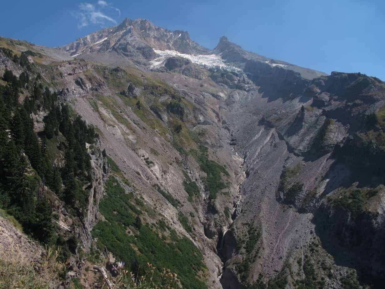
And another couple of videos, first a pan of the above shot. See all the waterfalls? My friend, who comes here often, said that stuff is usually covered with snow. We all know what that’s about in 2015 …
And now here’s a full panorama from just below the viewpoint, which you can see among the trees just to the right of Hood:
And by the way, the trail keeps going up that ridge left of Hood, climbing another 1,000 feet — or so I’m told. I will have to leave that for another day, which is another reason the Yocum Ridge hike got me so excited. I do a lot of hiking, including around Mount Hood, and it’s been a while since I got to experience something new.
It’s also been a while since I got to say this: I can’t wait to get back up explore that ridge some more!
Read more Portland hiking stuff here. Connect with Paul:
-
Twitter (@60HikesPortland)
-
Google+
-
“60 Hikes” page on Facebook.
-
Join a hiking trip to Europe
-
Subscribe to the free bi-weekly e-newsletter: