


(Note: Some of the links here are affiliate links, meaning if you make a purchase after clicking it, you might in essence buy me a coffee. Thanks!)
Every year in February, I start thinking about hiking my butt back into shape. I get out of shape every winter because I basically dislike (A) hiking in the rain, (B) driving on snow, and (C) the gym. So I eat and relax all winter, then hit the trails in the spring.
But which trails? What are the best options for hiking yourself into shape around Portland?
Here’s my list of 10 – yes, 10! – hikes which, if done in order, will gradually whip your hiking legs and lungs into shape. If you start in early March, like I usually do, and knock out one of these per week, as I sometimes do, you’ll be ready to roll when June hits.
Many of these are covered in my book, which you can get on Amazon.com:
I’m sure there’s all sorts of other great advice out there, like nutrition and eating well and strength building and yoga and meditation … but I’ll leave that stuff to people who actually, you know, do that stuff.
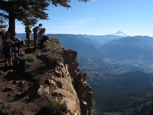
No. 1: Angels Rest
Start: In the Gorge at Angels Rest Trailhead. Distance: 4.6 miles. Elevation Gain: 1,600’
More from PortlandHikers.org or my book, 60 Hikes Within 60 Miles of Portland
Honestly, this is kind of a ceremonial first hike, intended mostly to kick off the season, see how bad the winter was on your body, and see if you can find your hiking gear again. Of course, it’s also a classic Gorge hike which, on weekends, will have half the population of Portland on it. It’s fun and festive, as a “preseason” hike should be.
No. 2: Hamilton Mountain
Start: In the Gorge at Beacon Rock State Park. Distance: 7.6 miles. Elevation Gain: 2,100’
More from PortlandHikers.org or my book, 60 Hikes Within 60 Miles of Portland
This one will feel pretty serious at times, but it’s shady on the way up, scenic on top, with a booming springtime waterfall on the way, and it’s probably snow-free, even if snow lingers on the Oregon side of the Gorge. As a warm-up, consider the one-mile dash up Beacon Rock across the road. Bonus early wildflowers are possible here.
No. 3: Devils Rest via Wahkeena
Start: In the Gorge at Wahkeena Falls. Distance: 7.4 miles. Elevation Gain: 2,400’
More from PortlandHikers.org or my book, 60 Hikes Within 60 Miles of Portland
Similar distance and mileage as last week, but steeper in the climb part. Devils Rest itself, which for some reason is 800 feet higher than Angels Rest on the same ridge, is a viewless disappointment. But the climb up beautiful Wahkeena Creek is worth all the effort. Be sure and detour to Wahkeena Spring. Also consider a car shuttle to return via Angles Rest or Multnomah Falls.
No. 4: Nick Eaton Way
Start: In the Gorge at Herman Creek Trailhead. Distance: 8 miles Elevation Gain: 2,600’
More from PortlandHikers.org or my book, 60 Hikes Within 60 Miles of Portland
Okay, now we’re getting steep. The walk-in along Herman Creek Trail is plain dull, but it’s a nice warmup for the ascent of Nick Eaton, which gains 1,960 feet in two miles. That’s steeper than Dog Mountain, by the way. (We’ll get to Dog later). At the top, you can cross the ridge to Indian Point, one of the truly amazing views of the Gorge, then descend on the mellow Gorton Creek Trail.
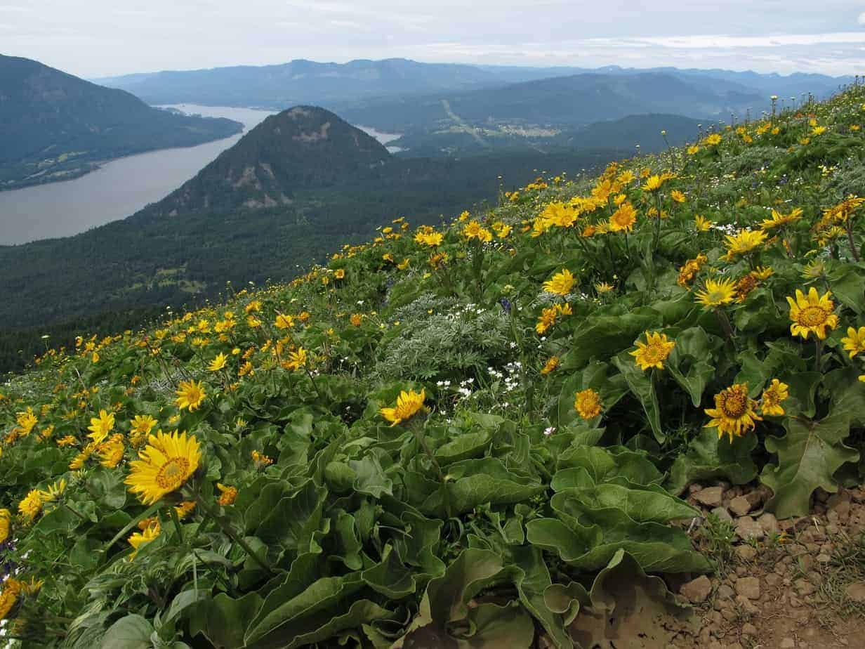
No. 5: Dog Mountain
Note: There is now a parking permit system in place for Dog Mountain from roughly mid April to mid June. Permits become available each year around March 1. Check with the Columbia River Gorge NSA for more information.
Start: The Gorge, Dog Mountain Trailhead. Distance: 7.2 miles. Elevation Gain: 2,900’
More from PortlandHikers.org or my book, 60 Hikes Within 60 Miles of Portland
I know the flower primetime is late May to early June, but it’s only halfway to our conditioning goal. I prefer going up the Augsperger Trail for shade and breeze, then down the steeper Dog Mountain Trail, but do what you want – then come back later to enjoy the flowers when you’re in awesome shape.
No. 6: Trapper Creek Loop
Alternative if closed or snowbound: The Catherine Creek – Coyote Wall Loop Hike is 11 miles and 2,600 feet, with lots of flowers in April.
Start: North of Carson, Washington at Government Mineral Springs.. Distance: 13.3 miles. Elevation Gain: 3,200’
More from PortlandHikers.org or my book, 60 Hikes Within 60 Miles of Portland
Beautiful old-growth forest, relative lack of people, great views on top, and a nice, long slog of a climb. The heart of it is a series of switchbacks over 2.5 miles that gain 1,700 feet – after you’ve hiked about five easy miles to get there. Rarely steep going up or down, this loop to Observation Peak (3,600’) will test your endurance nonetheless. Bonus: If you want to skip ahead on your conditioning, hike the Sunshine Trail. Just don’t say I didn’t warn you.
No. 7: Table Mountain
Start: In the Gorge at North Bonneville Trailhead. Distance: 16 miles. Elevation Gain: 3,650’
More from PortlandHikers.org or my book, 60 Hikes Within 60 Miles of Portland
Because Trapper Creek wasn’t steep enough, let’s get back to some thigh-busting nonsense. Table starts out a with long gradual uphill (2,000 feet in seven miles), then just gets mean. When you depart the PCT for the (yes) Heartbreak Ridge Trail, you’re about to gain 1,600 feet in 1.3 miles – net. See, there’s some downhill in there, as well. Nice. You also go up a steep boulder field to the summit – which is awesome, by the way. Not so much the trip down the West Ridge back to the PCT.

No. 8: Elk-King Traverse
Start: Along Highway 6 towards Tillamook, at the Elk Creek Trailhead.. Distance: 11 miles. Elevation Gain: 4,600’
More from PortlandHikers.org or my book, 60 Hikes Within 60 Miles of Portland
You will now get your butt thoroughly kicked. The good news is, you won’t have to wait to start climbing. Bad news: you don’t get to wait to start climbing. You’ll go 0.2 miles uphill from the trailhead, then gain 1,900 feet in 1.5 miles of “hiking” that is often closer to scrambling. Then you get a great view from Elk Mountain, then drop down (dammit!) and back up to a scary ridge traverse, highlighted by a fixed rope, then climb again (dammit!) to Kings Mountain, whose descent will make you miss coming down Dog Mountain. Oh, then you walk four miles back to your car. Mostly uphill. (Dammit!) Have fun!
No. 9: Tanner Butte
Update: As of May 2023, this trail is closed because of the 2017 Eagle Creek Fire. Check the National Forest website for the latest info.
Start: In the Gorge at Tooth Rock Trailhead. Distance: 18 miles. Elevation Gain: 4,450’
Alternate in the meantime: Larch Mountain Trail is “only” 14.4 miles and 4,000 feet, but it’s a classic from Multnomah Falls up to a mountain viewpoint.
After all that stupid-steep the last two weeks, let’s mellow it out a bit … or, rather, stretch it out. Remember, we’re building strength and endurance here, so if you have any of either left after last week, have at this monster. Though it’s “only” about 500 feet per mile, 9 miles up is a lot of miles up. And the last few miles aren’t technically “maintained.” It’s an epic hike, and a good choice for our next-to-last conditioner. It would also be a good backpacking loop, accessible from Eagle Creek Trail.
Keep up with all my writings, like hikes and travel, spirituality and soccer, by subscribing to my newsletter, liking my Facebook page, or following me on Twitter.
No. 10: Mount Defiance
Start: In the Gorge at Starvation Creek Rest Area.. Distance: 11.9 miles. Elevation Gain: 4,800’
More from PortlandHikers.org or my book, 60 Hikes Within 60 Miles of Portland.
The old joke in the Mazamas is that you climb Mount Hood to train for Mount Defiance. Indeed, Defiance is the highest point in the Gorge at 5,100 feet, so starting down by the Columbia River just seems unnecessary. (In fact, if you’ve been to the top of Dog and seen that hulking peak across the way, with the radio towers? That’s Defiance.) Even people who love Defiance describe it in ways that make it sound awful.
So, that’s a total of 99 miles and 32,300 feet of elevation gained – not bad for a few months’ work, eh? Let’s get on out there and make this thing happen!
Read more Portland hiking stuff here.
Connect with Paul:
-
Twitter (@authorpaulg)
-
60 Hikes page on Facebook.
-
Subscribe to the free monthly(ish) “Breakfast Bulletin” newsletter